Area Overview for PO9 5FH
Photos of PO9 5FH
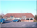
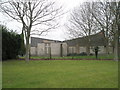
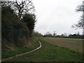
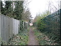
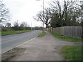
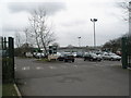
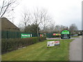
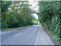
47 photos from this area
Area Information
Key information about the PO9 5FH including its size, population, and administrative classification.
- Area Type
- Postcode
- Area Size
- 4.2 hectares
- Population
- 2305
- Population Density
- 766 people/km²
House Prices in PO9 5FH
49
Properties
£346,084
Average Sold Price
£265,495
Lowest Price
£484,995
Highest Price
Showing 49 properties
| Address | Type | Beds | Baths | Last Sale Price | Last Sale Date | |
|---|---|---|---|---|---|---|
| 21 Normandy Way, Havant, PO9 5FH | Semi-detached | 3 | 2 | £335,000 | Mar 2025 | |
| 26 Normandy Way, Havant, PO9 5FH | house | - | - | £277,000 | Sep 2023 | |
| 33 Normandy Way, Havant, PO9 5FH | house | - | - | £430,995 | Oct 2021 | |
| 8 Normandy Way, Havant, PO9 5FH | house | - | - | £424,995 | Jun 2021 | |
| 17 Normandy Way, Havant, PO9 5FH | house | - | - | £434,995 | May 2021 | |
| 41 Normandy Way, Havant, PO9 5FH | house | - | - | £265,495 | Feb 2021 | |
| 39 Normandy Way, Havant, PO9 5FH | Semi-detached | 2 | 2 | £270,000 | Feb 2021 | |
| 37 Normandy Way, Havant, PO9 5FH | house | - | - | £270,000 | Feb 2021 | |
| 35 Normandy Way, Havant, PO9 5FH | house | - | - | £268,000 | Feb 2021 | |
| 14 Normandy Way, Havant, PO9 5FH | house | - | - | £335,995 | Nov 2020 |
Page 1 of 5
Energy Efficiency in PO9 5FH
Amenities
Schools
| Rank | School | Type | Entry gender | Ages |
|---|
Explore more schools in this area
Go to Schools tabDemographics
Household Size
Two person
most common
Accommodation Type
Houses
most common
Tenure
84
majority
Ethnic Group
White
most common
Religion
N/A
most common
Household Composition
N/A
most common
Age
47
median
Adults (30-64 years)
most common
Household Deprivation
N/A
with no deprivation
NS-SEC
47
in Lower managerial occupations
Explore more demographic insights in this area
Go to Demographics tabPlanning
Planning Constraints
- Flood RiskPremium
- Ramsar Wetland SitesPremium
- Area of Outstanding Natural BeautyPremium
- Protected Nature ReservePremium
- Protected WoodlandPremium