Area Overview for PO9 2BD
Photos of PO9 2BD
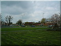
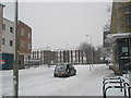
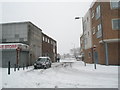
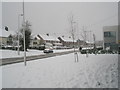
100 photos from this area
Area Information
Key information about the PO9 2BD including its size, population, and administrative classification.
- Area Type
- Postcode
- Area Size
- 6460 m²
- Population
- 2101
- Population Density
- 4591 people/km²
House Prices in PO9 2BD
22
Properties
£173,333
Average Sold Price
£53,500
Lowest Price
£260,000
Highest Price
Showing 22 properties
| Address | Type | Beds | Baths | Last Sale Price | Last Sale Date | |
|---|---|---|---|---|---|---|
| 137 Blendworth Crescent, Havant, PO9 2BD | Terraced | 2 | 1 | £260,000 | Oct 2025 | |
| 127 Blendworth Crescent, Havant, PO9 2BD | house | - | - | £260,000 | Jul 2022 | |
| 123 Blendworth Crescent, Havant, PO9 2BD | house | - | - | £209,000 | Apr 2021 | |
| 115 Blendworth Crescent, Havant, PO9 2BD | house | - | - | £195,000 | Dec 2019 | |
| 143 Blendworth Crescent, Havant, PO9 2BD | Semi-detached | 2 | 1 | £184,000 | Mar 2019 | |
| 125 Blendworth Crescent, Havant, PO9 2BD | Terraced | 3 | 1 | £140,500 | Oct 2013 | |
| 119 Blendworth Crescent, Havant, PO9 2BD | Terraced | - | - | £133,000 | Jul 2008 | |
| 109 Blendworth Crescent, Havant, PO9 2BD | Terraced | 2 | 1 | £125,000 | Apr 2005 | |
| 131 Blendworth Crescent, Havant, PO9 2BD | house | - | - | £53,500 | Jun 1999 | |
| 107 Blendworth Crescent, Havant, PO9 2BD | Flat | - | - | - | - |
Page 1 of 3
Energy Efficiency in PO9 2BD
Amenities
Schools
| Rank | School | Type | Entry gender | Ages |
|---|
Explore more schools in this area
Go to Schools tabDemographics
Household Size
Family (3-5 people)
most common
Accommodation Type
Houses
most common
Tenure
57
majority
Ethnic Group
White
most common
Religion
N/A
most common
Household Composition
N/A
most common
Age
47
median
Adults (30-64 years)
most common
Household Deprivation
N/A
with no deprivation
NS-SEC
19
in Lower managerial occupations
Explore more demographic insights in this area
Go to Demographics tabPlanning
Planning Constraints
- Flood RiskPremium
- Ramsar Wetland SitesPremium
- Area of Outstanding Natural BeautyPremium
- Protected Nature ReservePremium
- Protected WoodlandPremium