Area Overview for PO9 1RZ
Photos of PO9 1RZ
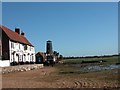
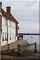
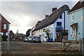

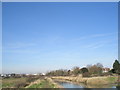
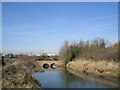
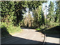
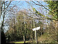
100 photos from this area
Area Information
Key information about the PO9 1RZ including its size, population, and administrative classification.
- Area Type
- Postcode
- Area Size
- 4912 m²
- Population
- 1555
- Population Density
- 839 people/km²
House Prices in PO9 1RZ
15
Properties
£287,204
Average Sold Price
£80,500
Lowest Price
£500,000
Highest Price
Showing 15 properties
| Address | Type | Beds | Baths | Last Sale Price | Last Sale Date | |
|---|---|---|---|---|---|---|
| 13 Towers Garden, Havant, PO9 1RZ | Terraced | 3 | 1 | £429,000 | Aug 2025 | |
| 4 Towers Garden, Havant, PO9 1RZ | house | - | - | £500,000 | Mar 2021 | |
| 3 Towers Garden, Havant, PO9 1RZ | house | - | - | £420,000 | Jun 2015 | |
| 9 Towers Garden, Havant, PO9 1RZ | house | 3 | - | £295,000 | Dec 2014 | |
| 11 Towers Garden, Havant, PO9 1RZ | house | 2 | - | £289,950 | Jul 2014 | |
| 10 Towers Garden, Havant, PO9 1RZ | Terraced | 3 | 2 | £250,000 | Oct 2013 | |
| 7 Towers Garden, Havant, PO9 1RZ | Terraced | 3 | 2 | £220,000 | Jul 2009 | |
| 1 Towers Garden, Havant, PO9 1RZ | Terraced | 3 | - | £385,000 | Feb 2007 | |
| 15 Towers Garden, Havant, PO9 1RZ | house | 4 | 1 | £280,000 | Jul 2004 | |
| 2 Towers Garden, Havant, PO9 1RZ | house | 4 | 2 | £197,000 | Aug 2000 |
Page 1 of 2
Energy Efficiency in PO9 1RZ
Amenities
Schools
| Rank | School | Type | Entry gender | Ages |
|---|
Explore more schools in this area
Go to Schools tabDemographics
Household Size
Two person
most common
Accommodation Type
Houses
most common
Tenure
88
majority
Ethnic Group
White
most common
Religion
N/A
most common
Household Composition
N/A
most common
Age
47
median
Adults (30-64 years)
most common
Household Deprivation
N/A
with no deprivation
NS-SEC
50
in Lower managerial occupations
Explore more demographic insights in this area
Go to Demographics tabPlanning
Planning Constraints
- Flood RiskPremium
- Ramsar Wetland SitesPremium
- Area of Outstanding Natural BeautyPremium
- Protected Nature ReservePremium
- Protected WoodlandPremium