Area Overview for PO9 1RS
Photos of PO9 1RS
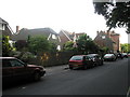
100 photos from this area
Area Information
Key information about the PO9 1RS including its size, population, and administrative classification.
- Area Type
- Postcode
- Area Size
- 3.2 hectares
- Population
- 1555
- Population Density
- 839 people/km²
House Prices in PO9 1RS
30
Properties
£341,303
Average Sold Price
£225,000
Lowest Price
£520,000
Highest Price
Showing 30 properties
| Address | Type | Beds | Baths | Last Sale Price | Last Sale Date | |
|---|---|---|---|---|---|---|
| 31 Langbrook Close, Havant, PO9 1RS | Detached | 3 | 1 | £520,000 | Dec 2024 | |
| 23 Langbrook Close, Havant, PO9 1RS | Detached | 5 | 2 | £500,000 | Aug 2020 | |
| 33 Langbrook Close, Havant, PO9 1RS | Detached | 3 | 2 | £365,000 | Oct 2019 | |
| 29 Langbrook Close, Havant, PO9 1RS | Detached | 4 | 1 | £340,000 | May 2019 | |
| 9 Langbrook Close, Havant, PO9 1RS | Detached | 4 | 1 | £379,950 | Mar 2019 | |
| 5 Langbrook Close, Havant, PO9 1RS | house | - | - | £400,000 | Apr 2017 | |
| 8 Langbrook Close, Havant, PO9 1RS | house | - | - | £375,000 | Nov 2015 | |
| 2 Langbrook Close, Havant, PO9 1RS | Detached | 4 | 1 | £325,000 | May 2010 | |
| 6 Langbrook Close, Havant, PO9 1RS | Detached | 5 | 2 | £382,500 | Dec 2009 | |
| 35 Langbrook Close, Havant, PO9 1RS | Detached | - | - | £345,000 | Jul 2007 |
Page 1 of 3
Energy Efficiency in PO9 1RS
Amenities
Schools
| Rank | School | Type | Entry gender | Ages |
|---|
Explore more schools in this area
Go to Schools tabDemographics
Household Size
Two person
most common
Accommodation Type
Houses
most common
Tenure
88
majority
Ethnic Group
White
most common
Religion
N/A
most common
Household Composition
N/A
most common
Age
47
median
Adults (30-64 years)
most common
Household Deprivation
N/A
with no deprivation
NS-SEC
50
in Lower managerial occupations
Explore more demographic insights in this area
Go to Demographics tabPlanning
Planning Constraints
- Flood RiskPremium
- Ramsar Wetland SitesPremium
- Area of Outstanding Natural BeautyPremium
- Protected Nature ReservePremium
- Protected WoodlandPremium