Area Overview for PO8 0ST
Photos of PO8 0ST
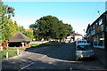
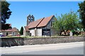
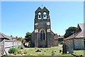
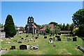
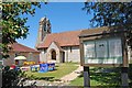
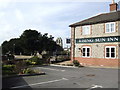
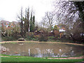
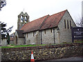
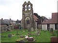
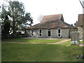
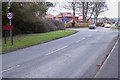
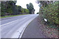
62 photos from this area
Area Information
Key information about the PO8 0ST including its size, population, and administrative classification.
- Area Type
- Postcode
- Area Size
- 2.5 hectares
- Population
- 1524
- Population Density
- 2647 people/km²
House Prices in PO8 0ST
43
Properties
£350,132
Average Sold Price
£89,000
Lowest Price
£595,000
Highest Price
Showing 43 properties
| Address | Type | Beds | Baths | Last Sale Price | Last Sale Date | |
|---|---|---|---|---|---|---|
| 10 Pipers Mead, Clanfield, Waterlooville, PO8 0ST | house | - | - | £500,000 | Jun 2025 | |
| 17 Pipers Mead, Clanfield, Waterlooville, PO8 0ST | Detached | 4 | 1 | £516,500 | Sep 2023 | |
| 15 Pipers Mead, Clanfield, Waterlooville, PO8 0ST | house | 4 | - | £595,000 | Aug 2022 | |
| 19 Pipers Mead, Clanfield, Waterlooville, PO8 0ST | Detached | 4 | 2 | £555,000 | Nov 2020 | |
| 25 Pipers Mead, Clanfield, Waterlooville, PO8 0ST | Detached | 4 | 2 | £450,000 | Sep 2019 | |
| 23 Pipers Mead, Clanfield, Waterlooville, PO8 0ST | Detached | 5 | - | £359,000 | Sep 2014 | |
| 38 Pipers Mead, Clanfield, Waterlooville, PO8 0ST | Detached | 4 | 2 | £340,000 | Jul 2014 | |
| 22 Pipers Mead, Clanfield, Waterlooville, PO8 0ST | Detached | 4 | 1 | £350,000 | Jul 2014 | |
| 29 Pipers Mead, Clanfield, Waterlooville, PO8 0ST | Detached | 4 | 1 | £340,000 | May 2014 | |
| 33 Pipers Mead, Clanfield, Waterlooville, PO8 0ST | Detached | - | - | £308,000 | Oct 2012 |
Page 1 of 5
Energy Efficiency in PO8 0ST
Amenities
Schools
| Rank | School | Type | Entry gender | Ages |
|---|
Explore more schools in this area
Go to Schools tabDemographics
Household Size
Two person
most common
Accommodation Type
Houses
most common
Tenure
89
majority
Ethnic Group
White
most common
Religion
N/A
most common
Household Composition
N/A
most common
Age
47
median
Adults (30-64 years)
most common
Household Deprivation
N/A
with no deprivation
NS-SEC
45
in Lower managerial occupations
Explore more demographic insights in this area
Go to Demographics tabPlanning
Planning Constraints
- Flood RiskPremium
- Ramsar Wetland SitesPremium
- Area of Outstanding Natural BeautyPremium
- Protected Nature ReservePremium
- Protected WoodlandPremium