Area Overview for PO7 8BG
Photos of PO7 8BG
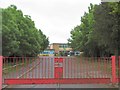
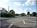
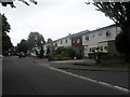
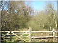
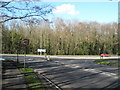
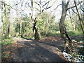
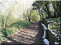
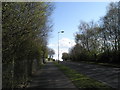
100 photos from this area
Area Information
Key information about the PO7 8BG including its size, population, and administrative classification.
- Area Type
- Postcode
- Area Size
- 7230 m²
- Population
- 1481
- Population Density
- 1242 people/km²
House Prices in PO7 8BG
35
Properties
£141,115
Average Sold Price
£23,000
Lowest Price
£312,500
Highest Price
Showing 35 properties
| Address | Type | Beds | Baths | Last Sale Price | Last Sale Date | |
|---|---|---|---|---|---|---|
| 4 Oracle Drive, Waterlooville, PO7 8BG | Terraced | 4 | 1 | £312,500 | May 2024 | |
| 35 Oracle Drive, Waterlooville, PO7 8BG | Flat | - | - | £160,000 | Apr 2021 | |
| 24 Oracle Drive, Waterlooville, PO7 8BG | Flat | - | - | £167,000 | May 2019 | |
| 27 Oracle Drive, Waterlooville, PO7 8BG | Flat | - | - | £159,000 | Dec 2018 | |
| 1 Oracle Drive, Waterlooville, PO7 8BG | Terraced | 4 | 1 | £265,000 | Apr 2018 | |
| 25 Oracle Drive, Waterlooville, PO7 8BG | Flat | - | - | £165,000 | May 2017 | |
| 6 Oracle Drive, Waterlooville, PO7 8BG | Terraced | 4 | - | £220,000 | Dec 2016 | |
| 26 Oracle Drive, Waterlooville, PO7 8BG | Flat | - | - | £167,000 | Oct 2016 | |
| 32 Oracle Drive, Waterlooville, PO7 8BG | Flat | - | - | £42,000 | Aug 2003 | |
| 28 Oracle Drive, Waterlooville, PO7 8BG | Flat | - | - | £23,000 | Mar 2003 |
Page 1 of 4
Energy Efficiency in PO7 8BG
Amenities
Schools
| Rank | School | Type | Entry gender | Ages |
|---|
Explore more schools in this area
Go to Schools tabDemographics
Household Size
One person
most common
Accommodation Type
Flats
most common
Tenure
43
majority
Ethnic Group
White
most common
Religion
N/A
most common
Household Composition
N/A
most common
Age
47
median
Adults (30-64 years)
most common
Household Deprivation
N/A
with no deprivation
NS-SEC
21
in Lower managerial occupations
Explore more demographic insights in this area
Go to Demographics tabPlanning
Planning Constraints
- Flood RiskPremium
- Ramsar Wetland SitesPremium
- Area of Outstanding Natural BeautyPremium
- Protected Nature ReservePremium
- Protected WoodlandPremium