Area Overview for PO7 7NE
Photos of PO7 7NE
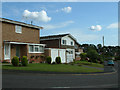
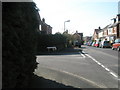
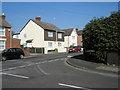
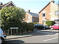
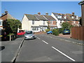
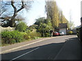
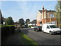
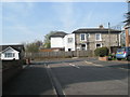
100 photos from this area
Area Information
Key information about the PO7 7NE including its size, population, and administrative classification.
- Area Type
- Postcode
- Area Size
- 3.2 hectares
- Population
- 1421
- Population Density
- 3711 people/km²
House Prices in PO7 7NE
16
Properties
£341,455
Average Sold Price
£123,000
Lowest Price
£550,000
Highest Price
Showing 16 properties
| Address | Type | Beds | Baths | Last Sale Price | Last Sale Date | |
|---|---|---|---|---|---|---|
| 62 Hurstville Drive, Waterlooville, PO7 7NE | Detached | 4 | 1 | £550,000 | Mar 2025 | |
| 54 Hurstville Drive, Waterlooville, PO7 7NE | house | 3 | 1 | £456,000 | May 2022 | |
| 58 Hurstville Drive, Waterlooville, PO7 7NE | Detached | 4 | 1 | £380,000 | Oct 2020 | |
| 46 Hurstville Drive, Waterlooville, PO7 7NE | Semi-detached | 4 | - | £360,000 | Sep 2020 | |
| 52 Hurstville Drive, Waterlooville, PO7 7NE | Detached | 4 | 3 | £405,000 | Dec 2019 | |
| 56 Hurstville Drive, Waterlooville, PO7 7NE | Detached | 4 | 1 | £370,000 | Dec 2018 | |
| 41 Hurstville Drive, Waterlooville, PO7 7NE | Detached | 4 | 1 | £342,000 | Nov 2017 | |
| 48 Hurstville Drive, Waterlooville, PO7 7NE | Detached | 4 | 2 | £205,000 | May 2011 | |
| 39 Hurstville Drive, Waterlooville, PO7 7NE | house | 1 | 2 | £280,000 | Apr 2007 | |
| 43 Hurstville Drive, Waterlooville, PO7 7NE | Detached | 4 | 2 | £285,000 | Jul 2004 |
Page 1 of 2
Energy Efficiency in PO7 7NE
Amenities
Schools
| Rank | School | Type | Entry gender | Ages |
|---|
Explore more schools in this area
Go to Schools tabDemographics
Household Size
Two person
most common
Accommodation Type
Houses
most common
Tenure
71
majority
Ethnic Group
White
most common
Religion
N/A
most common
Household Composition
N/A
most common
Age
47
median
Adults (30-64 years)
most common
Household Deprivation
N/A
with no deprivation
NS-SEC
38
in Lower managerial occupations
Explore more demographic insights in this area
Go to Demographics tabPlanning
Planning Constraints
- Flood RiskPremium
- Ramsar Wetland SitesPremium
- Area of Outstanding Natural BeautyPremium
- Protected Nature ReservePremium
- Protected WoodlandPremium