Area Overview for PO7 6QA
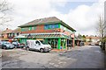
Photos of PO7 6QA


Area Information
Living in PO7 6QA offers a distinct residential experience within a tightly knit cluster. This specific postcode covers an area of just 6159 square metres, yet it supports a population of 2861 people. The result is a neighbourhood with a moderate density of 380 people per square kilometre, creating a community that feels established without excessive sprawl. Residents here enjoy the practicalities of a defined local zone where daily routines are familiar. You are part of a community where the built environment is compact, making local navigation straightforward for anyone considering homes in PO7 6QA. The area lacks the chaotic energy of larger urban hubs, instead offering a quieter setting where residents know their immediate surroundings. This concentration allows for direct access to local services without the isolation of less populated rural sites. When you look at the character of this zone, it is defined by its residential focus and the specific boundaries that shape daily life for its 2861 inhabitants.
- Area Type
- Postcode
- Area Size
- 6159 m²
- Population
- 2861
- Population Density
- 380 people/km²
The property market in PO7 6QA is defined by a strong preference for homeownership and traditional housing stock. Seven out of every ten households own their homes outright or with a mortgage, creating a community where buyers often plan for long-term residency rather than short-term tenancy. This high ownership rate of 78 per cent means that the local housing market supports individuals looking to settle down rather than investors seeking rental yields. Accommodation across the area consists primarily of Houses, which caters to those requiring space beyond the limitations of flats or maisonettes. If you are looking at homes in PO7 6QA, you can expect a landscape dominated by detached or semi-detached properties built for family living. The scarcity of rental properties within the immediate cluster suggests a market that has evolved to favour owner-occupied stock. This stability means that when you buy a home here, you become part of a network of permanent residents. The nature of the housing stock directly mirrors the older, established demographic profile of the neighbourhood.
House Prices in PO7 6QA
Showing 8 properties
| Address | Type | Beds | Baths | Last Sale Price | Last Sale Date | |
|---|---|---|---|---|---|---|
| Sunnymead, Hambledon Road, Denmead, PO7 6QA | Detached | 4 | 2 | £535,000 | Sep 2025 | |
| Enfield, Hambledon Road, Denmead, PO7 6QA | Detached | 4 | 5 | £775,000 | Aug 2024 | |
| Oakleigh, Hambledon Road, Denmead, PO7 6QA | Bungalow | 3 | 1 | £395,000 | Jun 2024 | |
| The Yews, Hambledon Road, Denmead, PO7 6QA | house | - | - | £442,500 | Aug 2018 | |
| The Glen, Hambledon Road, Denmead, PO7 6QA | Bungalow | 3 | 1 | £365,000 | Jun 2017 | |
| Daintree, Hambledon Road, Denmead, PO7 6QA | Semi-detached | 3 | - | £60,000 | Dec 1996 | |
| Moordown, Hambledon Road, Denmead, PO7 6QA | Detached | - | - | £130,450 | Sep 1996 | |
| Meadowsweet Cottage, Hambledon Road, Denmead, PO7 6QA | Detached | 6 | 2 | - | - |
Energy Efficiency in PO7 6QA
Daily life in PO7 6QA is anchored by convenient access to essential retail and leisure facilities. You are within easy reach of five key retail destinations that serve the local needs of the 2861 residents. These include The Southern Co-operative Co, Morrisons Daily, and Lidl Elettra, providing a comprehensive range of groceries and daily necessities without the need for long journeys. For those who prefer travelling by train for their daily commute, five railway stations lie nearby. Cosham Railway Station, Bedhampton Railway Station, and Rowlands Castle Railway Station form a convenient network that integrates easily with local transport routes. The proximity of these amenities means you can shop for fresh produce or specific household items quickly. This layout supports a lifestyle where daily errands are manageable and local services are prioritised. You do not need to venture far to find the services required for a comfortable household routine. The presence of specific named retailers and transport hubs grounds the experience of living in this postcode in practical reality.
Amenities
Schools
| Rank | School | Type | Entry gender | Ages |
|---|
Explore more schools in this area
Go to Schools tabDemographics
The community profile in PO7 6QA reflects a settled, mature population. The median age stands at 47 years, confirming that Adults aged between 30 and 64 years represent the most common age range. This demographic skew suggests a neighbourhood where long-term residents have put down roots rather than transient students or young professionals dominating the street scene. You are likely to find families and empty-nesters living alongside one another in this stable environment. Home ownership is exceptionally high at 78 per cent, indicating that the vast majority of households have purchased their residences rather than renting. This figure underscores the stability of the local population and the value placed on owning a property in this location. Almost all accommodation within this area consists of Houses, aligning with the preferences of this older demographic. The predominant ethnic group in the neighbourhood is White, which shapes the cultural fabric of the local community. With such a high level of ownership and a clear age profile, the social dynamics are predictable and consistent.
Household Size
Accommodation Type
Tenure
Ethnic Group
Religion
Household Composition
Age
Household Deprivation
NS-SEC
Explore more demographic insights in this area
Go to Demographics tabPlanning
Planning Constraints
- Flood RiskPremium
- Ramsar Wetland SitesPremium
- Area of Outstanding Natural BeautyPremium
- Protected Nature ReservePremium
- Protected WoodlandPremium