Area Overview for PO6 4SY
Photos of PO6 4SY
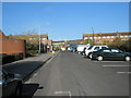
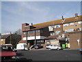
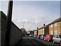
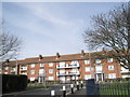
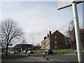
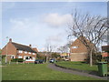
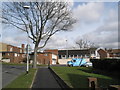
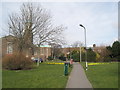
100 photos from this area
Area Information
Key information about the PO6 4SY including its size, population, and administrative classification.
- Area Type
- Postcode
- Area Size
- 1.0 hectares
- Population
- 1468
- Population Density
- 3162 people/km²
House Prices in PO6 4SY
34
Properties
£290,326
Average Sold Price
£76,000
Lowest Price
£562,500
Highest Price
Showing 34 properties
| Address | Type | Beds | Baths | Last Sale Price | Last Sale Date | |
|---|---|---|---|---|---|---|
| 28 Carne Place, Portsmouth, PO6 4SY | Terraced | 3 | 2 | £380,000 | Mar 2025 | |
| 31 Carne Place, Portsmouth, PO6 4SY | Retail | 3 | 2 | £400,000 | Sep 2022 | |
| 2 Carne Place, Portsmouth, PO6 4SY | Terraced | 4 | 3 | £562,500 | Aug 2022 | |
| 32 Carne Place, Portsmouth, PO6 4SY | Semi-detached | 3 | 2 | £380,000 | Sep 2021 | |
| 29 Carne Place, Portsmouth, PO6 4SY | Terraced | 3 | 2 | £499,995 | Apr 2021 | |
| 25 Carne Place, Portsmouth, PO6 4SY | Terraced | 3 | 1 | £305,000 | Feb 2021 | |
| 20 Carne Place, Portsmouth, PO6 4SY | Semi-detached | 4 | 1 | £467,500 | Sep 2020 | |
| 30 Carne Place, Portsmouth, PO6 4SY | Terraced | 3 | 2 | £305,000 | Mar 2017 | |
| 16 Carne Place, Portsmouth, PO6 4SY | Semi-detached | 3 | 2 | £349,995 | Nov 2016 | |
| 1 Carne Place, Portsmouth, PO6 4SY | Terraced | 4 | 1 | £330,000 | Mar 2016 |
Page 1 of 4
Energy Efficiency in PO6 4SY
Amenities
Schools
| Rank | School | Type | Entry gender | Ages |
|---|
Explore more schools in this area
Go to Schools tabDemographics
Household Size
Two person
most common
Accommodation Type
Houses
most common
Tenure
70
majority
Ethnic Group
White
most common
Religion
N/A
most common
Household Composition
N/A
most common
Age
47
median
Adults (30-64 years)
most common
Household Deprivation
N/A
with no deprivation
NS-SEC
46
in Lower managerial occupations
Explore more demographic insights in this area
Go to Demographics tabPlanning
Planning Constraints
- Flood RiskPremium
- Ramsar Wetland SitesPremium
- Area of Outstanding Natural BeautyPremium
- Protected Nature ReservePremium
- Protected WoodlandPremium