Area Overview for PO6 4SQ
Photos of PO6 4SQ
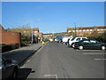
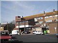
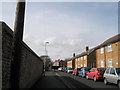
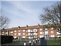
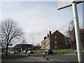
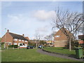
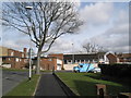
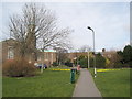
100 photos from this area
Area Information
Key information about the PO6 4SQ including its size, population, and administrative classification.
- Area Type
- Postcode
- Area Size
- 1.6 hectares
- Population
- 1468
- Population Density
- 3162 people/km²
House Prices in PO6 4SQ
64
Properties
£165,900
Average Sold Price
£46,500
Lowest Price
£310,000
Highest Price
Showing 64 properties
| Address | Type | Beds | Baths | Last Sale Price | Last Sale Date | |
|---|---|---|---|---|---|---|
| 65 Farmlea Road, Portsmouth, PO6 4SQ | Terraced | 3 | 1 | £310,000 | Sep 2025 | |
| 100 Farmlea Road, Portsmouth, PO6 4SQ | Terraced | 4 | 2 | £300,000 | Apr 2022 | |
| 43 Farmlea Road, Portsmouth, PO6 4SQ | house | 3 | 1 | £255,000 | Feb 2022 | |
| 134 Farmlea Road, Portsmouth, PO6 4SQ | Terraced | 2 | 1 | £220,000 | Sep 2021 | |
| 174 Farmlea Road, Portsmouth, PO6 4SQ | Semi-detached | 3 | - | £260,000 | May 2021 | |
| 142 Farmlea Road, Portsmouth, PO6 4SQ | Terraced | 3 | 1 | £235,000 | May 2021 | |
| 130 Farmlea Road, Portsmouth, PO6 4SQ | Terraced | 2 | 1 | £210,000 | Apr 2021 | |
| 172 Farmlea Road, Portsmouth, PO6 4SQ | Detached | 3 | 1 | £265,000 | Jan 2021 | |
| 164 Farmlea Road, Portsmouth, PO6 4SQ | Terraced | 3 | 2 | £260,000 | Jan 2020 | |
| 96 Farmlea Road, Portsmouth, PO6 4SQ | Terraced | 3 | 1 | £230,000 | Jul 2019 |
Page 1 of 7
Energy Efficiency in PO6 4SQ
Amenities
Schools
| Rank | School | Type | Entry gender | Ages |
|---|
Explore more schools in this area
Go to Schools tabDemographics
Household Size
Two person
most common
Accommodation Type
Houses
most common
Tenure
70
majority
Ethnic Group
White
most common
Religion
N/A
most common
Household Composition
N/A
most common
Age
47
median
Adults (30-64 years)
most common
Household Deprivation
N/A
with no deprivation
NS-SEC
46
in Lower managerial occupations
Explore more demographic insights in this area
Go to Demographics tabPlanning
Planning Constraints
- Flood RiskPremium
- Ramsar Wetland SitesPremium
- Area of Outstanding Natural BeautyPremium
- Protected Nature ReservePremium
- Protected WoodlandPremium