Area Overview for PO6 4QS
Photos of PO6 4QS


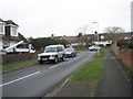
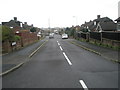
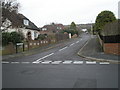
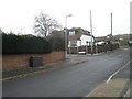
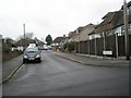
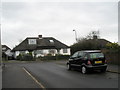
100 photos from this area
Area Information
Key information about the PO6 4QS including its size, population, and administrative classification.
- Area Type
- Postcode
- Area Size
- 9195 m²
- Population
- 1660
- Population Density
- 907 people/km²
House Prices in PO6 4QS
28
Properties
£157,065
Average Sold Price
£31,200
Lowest Price
£316,000
Highest Price
Showing 28 properties
| Address | Type | Beds | Baths | Last Sale Price | Last Sale Date | |
|---|---|---|---|---|---|---|
| 328 Allaway Avenue, Portsmouth, PO6 4QS | house | - | - | £247,000 | Feb 2025 | |
| 286 Allaway Avenue, Portsmouth, PO6 4QS | Terraced | 3 | 2 | £316,000 | Jan 2023 | |
| 326 Allaway Avenue, Portsmouth, PO6 4QS | house | - | - | £220,000 | Jun 2021 | |
| 332 Allaway Avenue, Portsmouth, PO6 4QS | house | - | - | £230,000 | Jan 2021 | |
| 320 Allaway Avenue, Portsmouth, PO6 4QS | Terraced | 3 | - | £197,500 | Aug 2019 | |
| 336 Allaway Avenue, Portsmouth, PO6 4QS | Terraced | 3 | 1 | £210,000 | Jan 2019 | |
| 330 Allaway Avenue, Portsmouth, PO6 4QS | Terraced | 4 | - | £169,995 | Apr 2016 | |
| 306 Allaway Avenue, Portsmouth, PO6 4QS | Terraced | 4 | 1 | £158,000 | Aug 2015 | |
| 308 Allaway Avenue, Portsmouth, PO6 4QS | house | 3 | - | £163,995 | Aug 2014 | |
| 324 Allaway Avenue, Portsmouth, PO6 4QS | Terraced | 3 | 1 | £120,000 | Oct 2011 |
Page 1 of 3
Energy Efficiency in PO6 4QS
Amenities
Schools
| Rank | School | Type | Entry gender | Ages |
|---|
Explore more schools in this area
Go to Schools tabDemographics
Household Size
Two person
most common
Accommodation Type
Houses
most common
Tenure
74
majority
Ethnic Group
White
most common
Religion
N/A
most common
Household Composition
N/A
most common
Age
47
median
Adults (30-64 years)
most common
Household Deprivation
N/A
with no deprivation
NS-SEC
28
in Lower managerial occupations
Explore more demographic insights in this area
Go to Demographics tabPlanning
Planning Constraints
- Flood RiskPremium
- Ramsar Wetland SitesPremium
- Area of Outstanding Natural BeautyPremium
- Protected Nature ReservePremium
- Protected WoodlandPremium