Area Overview for PO6 4HJ
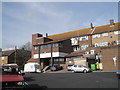
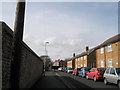
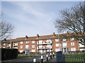
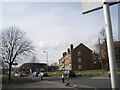
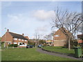
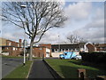
Photos of PO6 4HJ


Area Information
Living in PO6 4HJ means residing within a compact residential cluster defined by its specific postcode. This very small area covers just 4757 square metres, containing a population of 1666 people. The density stands at 350205 people per square kilometre, reflecting a tightly packed neighbourhood where daily life revolves around immediate surroundings. Prospective buyers often seek this location for its proximity to Portsmouth, yet the area itself functions as a focused residential enclave. There are no large parks or industrial zones within these boundaries; instead, the focus is entirely on housing. The community is characterised by a distinct age profile, with the majority of residents falling into the adult bracket between 30 and 64 years of age. This demographic focus shapes the character of the streets, influencing everything from local shop hours to community activities. You will find that the environment is built for established households rather than transient populations. The sheer scale of the area means that noise and activity are contained within close proximity, creating a predictable routine. For those considering homes in PO6 4HJ, the primary appeal lies in its defined nature and clear residential purpose rather than expansive green spaces or suburban sprawl.
- Area Type
- Postcode
- Area Size
- 4757 m²
- Population
- 1666
- Population Density
- 4638 people/km²
The property market in PO6 4HJ is defined by a specific housing stock that prioritises traditional architecture. Houses form the predominant accommodation type, catering to families and individuals seeking single-story or semi-detached living. Since 37% of the population owns their homes, there is a significant presence of owner-occupiers alongside a large number of renters. This split indicates that the local market serves both investors looking for rental yields and families purchasing static properties. The compact size of the area, covering only 4757 square metres, limits the variety of property developments available compared to larger districts. Buyers looking at PO6 4HJ should prepare for a market focused on existing houses rather than new builds or converted apartments. The high population density of 350205 people per square kilometre often correlates with constrained land availability, which can influence property values and maintenance costs. When considering homes in this postcode, expect a market that values established character over modern modifications. The 37% ownership rate further suggests that rental supply is robust for those not ready to commit to a mortgage. Understanding this balance helps you evaluate whether purchasing now or renting to test the waters is the better financial decision. The lack of data on specific price trends means evaluating individual property conditions remains the primary method for determining value.
House Prices in PO6 4HJ
Showing 6 properties
| Address | Type | Beds | Baths | Last Sale Price | Last Sale Date | |
|---|---|---|---|---|---|---|
| 204 Allaway Avenue, Portsmouth, PO6 4HJ | Semi-detached | 3 | 1 | £259,000 | Mar 2025 | |
| 198 Allaway Avenue, Portsmouth, PO6 4HJ | Semi-detached | 3 | 1 | £215,000 | Apr 2018 | |
| 202 Allaway Avenue, Portsmouth, PO6 4HJ | Semi-detached | 3 | 1 | £241,000 | Oct 2017 | |
| 206 Allaway Avenue, Portsmouth, PO6 4HJ | Semi-detached | - | - | - | - | |
| 196 Allaway Avenue, Portsmouth, PO6 4HJ | house | - | - | - | - | |
| 200 Allaway Avenue, Portsmouth, PO6 4HJ | Semi-detached | - | - | - | - |
Energy Efficiency in PO6 4HJ
Daily life in PO6 4HJ is enhanced by a selection of amenities located within practical reach of the residential cluster. Residents have access to five retail venues, including Aldi Paulsgrove, Spar, and Tesco Portsmouth, ensuring everyday shopping needs are met without travel. Five rail stations provide transport links, with Portchester Railway Station, Cosham Railway Station, and Hilsea Railway Station offering connections to the wider region. Additionally, five ferry terminals are available nearby, including Portsmouth International Cruise and Ferry Terminal and Portsmouth Harbour Station Pier, facilitating sea travel options. Gosport Ferry Terminal also serves the area, providing alternative routes for commuters and tourists. The concentration of transport hubs means you are well-connected to Portsmouth and surrounding coastal towns. Leisure activities are supported by the proximity to major cruise terminals and ferry hubs, which bring a constant flow of activity to the broader vicinity. While the area itself is residential, the proximity to these major terminals integrates the neighbourhood into a larger network of leisure and employment. Convenience is a key feature, with essential shops and multiple transport options just a short distance away. This mix of retail and transport infrastructure provides a solid foundation for an active daily routine.
Amenities
Schools
Families living in PO6 4HJ have access to a range of educational institutions within practical reach of their homes. St Paul's Catholic Primary School is a notable option with an Ofsted rating of good, offering a structured primary education environment. Hillside Middle School serves as another primary choice for younger children, though it does not have a specified Ofsted rating in current records. Hill View First School also operates as a primary institution, adding to the local educational provision. The presence of multiple primary schools suggests a concentration of early education facilities in the region. You will find that secondary education is not listed among the nearby schools, so families may need to look further afield for older children's schooling. The availability of three named primary schools indicates that early childhood education is well-supported in the immediate vicinity. When researching schools near PO6 4HJ, parents should verify current capacity and catchment areas for specific years of interest. The mix of schools with and without Ofsted ratings means conducting additional due diligence on educational standards before making a move. St Paul's Catholic Primary School stands out with its explicit good grading, providing a clear benchmark for quality.
| Rank | School | Type | Entry gender | Ages |
|---|
Explore more schools in this area
Go to Schools tabDemographics
The community in PO6 4HJ reflects a mature population with a median age of 47 years. Most residents are adults aged between 30 and 64 years, indicating a neighbourhood settled by families and long-term professionals. Home ownership accounts for 37% of the local population, meaning the majority of households live in rented accommodation. Housing throughout the area consists predominantly of houses, providing the main accommodation type for this postcode. The ethnic composition is predominantly White, contributing to a relatively homogenous community atmosphere. With 37% of residents owning their homes, the area offers a balance between investment buyers and private tenants. The higher rate of renting suggests a dynamic market where properties turnover regularly to meet changing family needs. Deprivation data is not included in the provided statistics, allowing for a neutral assessment focused on the clear majority of adult residents. This age profile suggests a stable demographic where residents have likely established roots in the local area. Whether you are looking for a family home or a rental property, the demographic makeup indicates a settled environment. The mix of owner-occupiers and renters creates a diverse living experience within these specific boundaries.
Household Size
Accommodation Type
Tenure
Ethnic Group
Religion
Household Composition
Age
Household Deprivation
NS-SEC
Explore more demographic insights in this area
Go to Demographics tabPlanning
Planning Constraints
- Flood RiskPremium
- Ramsar Wetland SitesPremium
- Area of Outstanding Natural BeautyPremium
- Protected Nature ReservePremium
- Protected WoodlandPremium