Area Overview for PO6 3SH
Photos of PO6 3SH
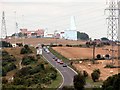
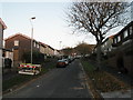
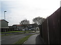
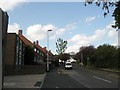
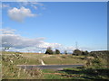
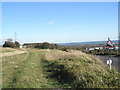
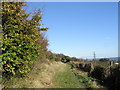
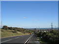
100 photos from this area
Area Information
Key information about the PO6 3SH including its size, population, and administrative classification.
- Area Type
- Postcode
- Area Size
- 6.6 hectares
- Population
- 1384
- Population Density
- 3767 people/km²
House Prices in PO6 3SH
40
Properties
£131,619
Average Sold Price
£21,900
Lowest Price
£240,000
Highest Price
Showing 40 properties
| Address | Type | Beds | Baths | Last Sale Price | Last Sale Date | |
|---|---|---|---|---|---|---|
| 102 Blakemere Crescent, Portsmouth, PO6 3SH | Terraced | 4 | 1 | £240,000 | Sep 2022 | |
| 65 Blakemere Crescent, Portsmouth, PO6 3SH | house | - | - | £182,000 | May 2021 | |
| 106 Blakemere Crescent, Portsmouth, PO6 3SH | Terraced | 3 | 1 | £181,000 | Mar 2020 | |
| 89 Blakemere Crescent, Portsmouth, PO6 3SH | Semi-detached | 3 | 1 | £185,000 | Jun 2017 | |
| 94 Blakemere Crescent, Portsmouth, PO6 3SH | Semi-detached | 3 | 1 | £182,000 | May 2017 | |
| 83 Blakemere Crescent, Portsmouth, PO6 3SH | house | 3 | - | £185,000 | Feb 2017 | |
| 73 Blakemere Crescent, Portsmouth, PO6 3SH | house | - | - | £135,000 | Nov 2015 | |
| 108 Blakemere Crescent, Portsmouth, PO6 3SH | Terraced | 3 | 1 | £135,000 | Oct 2015 | |
| 87 Blakemere Crescent, Portsmouth, PO6 3SH | Semi-detached | 3 | - | £135,000 | Dec 2013 | |
| 61 Blakemere Crescent, Portsmouth, PO6 3SH | Semi-detached | 3 | 1 | £127,500 | Nov 2007 |
Page 1 of 4
Energy Efficiency in PO6 3SH
Amenities
Schools
| Rank | School | Type | Entry gender | Ages |
|---|
Explore more schools in this area
Go to Schools tabDemographics
Household Size
Family (3-5 people)
most common
Accommodation Type
Houses
most common
Tenure
61
majority
Ethnic Group
White
most common
Religion
N/A
most common
Household Composition
N/A
most common
Age
47
median
Adults (30-64 years)
most common
Household Deprivation
N/A
with no deprivation
NS-SEC
18
in Lower managerial occupations
Explore more demographic insights in this area
Go to Demographics tabPlanning
Planning Constraints
- Flood RiskPremium
- Ramsar Wetland SitesPremium
- Area of Outstanding Natural BeautyPremium
- Protected Nature ReservePremium
- Protected WoodlandPremium