Area Overview for PO6 3SA
Photos of PO6 3SA
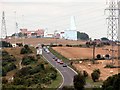
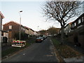
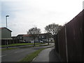
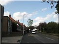
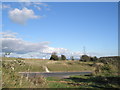
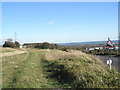
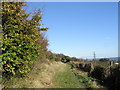
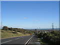
100 photos from this area
Area Information
Key information about the PO6 3SA including its size, population, and administrative classification.
- Area Type
- Postcode
- Area Size
- 1.3 hectares
- Population
- 1505
- Population Density
- 5686 people/km²
House Prices in PO6 3SA
48
Properties
£156,337
Average Sold Price
£39,000
Lowest Price
£310,000
Highest Price
Showing 48 properties
| Address | Type | Beds | Baths | Last Sale Price | Last Sale Date | |
|---|---|---|---|---|---|---|
| 24 Washbrook Road, Portsmouth, PO6 3SA | Semi-detached | 2 | 1 | £235,000 | Apr 2025 | |
| 19 Washbrook Road, Portsmouth, PO6 3SA | Semi-detached | 3 | 1 | £257,500 | Feb 2024 | |
| 53 Washbrook Road, Portsmouth, PO6 3SA | Semi-detached | 3 | 1 | £310,000 | Oct 2022 | |
| 39 Washbrook Road, Portsmouth, PO6 3SA | Semi-detached | 3 | - | £265,000 | Sep 2021 | |
| 7 Washbrook Road, Portsmouth, PO6 3SA | Bungalow | - | - | £265,000 | Jun 2021 | |
| 9 Washbrook Road, Portsmouth, PO6 3SA | house | - | - | £225,000 | Sep 2020 | |
| 29 Washbrook Road, Portsmouth, PO6 3SA | Semi-detached | 3 | 1 | £230,000 | Aug 2019 | |
| 4 Washbrook Road, Portsmouth, PO6 3SA | Semi-detached | 3 | 1 | £194,000 | Jan 2019 | |
| 27 Washbrook Road, Portsmouth, PO6 3SA | Semi-detached | 3 | 1 | £226,500 | Oct 2018 | |
| 36 Washbrook Road, Portsmouth, PO6 3SA | Semi-detached | 2 | - | £165,000 | Aug 2016 |
Page 1 of 5
Energy Efficiency in PO6 3SA
Amenities
Schools
| Rank | School | Type | Entry gender | Ages |
|---|
Explore more schools in this area
Go to Schools tabDemographics
Household Size
Family (3-5 people)
most common
Accommodation Type
Houses
most common
Tenure
40
majority
Ethnic Group
White
most common
Religion
N/A
most common
Household Composition
N/A
most common
Age
47
median
Adults (30-64 years)
most common
Household Deprivation
N/A
with no deprivation
NS-SEC
19
in Lower managerial occupations
Explore more demographic insights in this area
Go to Demographics tabPlanning
Planning Constraints
- Flood RiskPremium
- Ramsar Wetland SitesPremium
- Area of Outstanding Natural BeautyPremium
- Protected Nature ReservePremium
- Protected WoodlandPremium