Area Overview for PO6 3NL
Photos of PO6 3NL
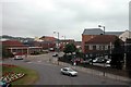
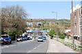

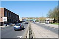
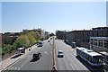

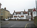
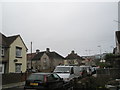
100 photos from this area
Area Information
Key information about the PO6 3NL including its size, population, and administrative classification.
- Area Type
- Postcode
- Area Size
- 1.1 hectares
- Population
- 1479
- Population Density
- 5426 people/km²
House Prices in PO6 3NL
26
Properties
£186,583
Average Sold Price
£115,000
Lowest Price
£325,000
Highest Price
Showing 26 properties
| Address | Type | Beds | Baths | Last Sale Price | Last Sale Date | |
|---|---|---|---|---|---|---|
| 52 Old Wymering Lane, Portsmouth, PO6 3NL | house | - | - | £290,000 | Nov 2024 | |
| 54 Old Wymering Lane, Portsmouth, PO6 3NL | Semi-detached | 4 | 1 | £300,000 | Aug 2023 | |
| 27 Old Wymering Lane, Portsmouth, PO6 3NL | Flat | - | - | £140,000 | Feb 2023 | |
| 60 Old Wymering Lane, Portsmouth, PO6 3NL | Retail | 4 | 2 | £325,000 | Aug 2022 | |
| 19 Old Wymering Lane, Portsmouth, PO6 3NL | Flat | - | - | £133,000 | Mar 2021 | |
| 76 Old Wymering Lane, Portsmouth, PO6 3NL | Flat | - | - | £125,000 | Jan 2021 | |
| 29 Old Wymering Lane, Portsmouth, PO6 3NL | Flat | - | - | £130,000 | Jan 2021 | |
| 68 Old Wymering Lane, Portsmouth, PO6 3NL | Flat | - | - | £129,000 | Feb 2020 | |
| 25 Old Wymering Lane, Portsmouth, PO6 3NL | Flat | - | - | £115,000 | Jul 2018 | |
| 74 Old Wymering Lane, Portsmouth, PO6 3NL | Flat | - | - | £124,000 | Sep 2017 |
Page 1 of 3
Energy Efficiency in PO6 3NL
Amenities
Schools
| Rank | School | Type | Entry gender | Ages |
|---|
Explore more schools in this area
Go to Schools tabDemographics
Household Size
Two person
most common
Accommodation Type
Houses
most common
Tenure
54
majority
Ethnic Group
White
most common
Religion
N/A
most common
Household Composition
N/A
most common
Age
47
median
Adults (30-64 years)
most common
Household Deprivation
N/A
with no deprivation
NS-SEC
22
in Lower managerial occupations
Explore more demographic insights in this area
Go to Demographics tabPlanning
Planning Constraints
- Flood RiskPremium
- Ramsar Wetland SitesPremium
- Area of Outstanding Natural BeautyPremium
- Protected Nature ReservePremium
- Protected WoodlandPremium