Area Overview for PO6 3JL
Photos of PO6 3JL
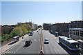
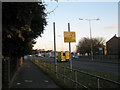
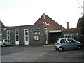
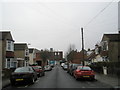
100 photos from this area
Area Information
Key information about the PO6 3JL including its size, population, and administrative classification.
- Area Type
- Postcode
- Area Size
- 4.6 hectares
- Population
- 2157
- Population Density
- 2668 people/km²
House Prices in PO6 3JL
6
Properties
-
Average Sold Price
-
Lowest Price
-
Highest Price
Showing 6 properties
| Address | Type | Beds | Baths | Last Sale Price | Last Sale Date | |
|---|---|---|---|---|---|---|
| Hampshire And Isle Of Wight Fire And Rescue Service, Cosham Fire Station, Sundridge Close, Portsmouth, PO6 3JL | emergency_services | - | - | - | - | |
| Cosham Police Station, Sundridge Close, Portsmouth, PO6 3JL | commercial | - | - | - | - | |
| School Lodge, Sundridge Close, Portsmouth, PO6 3JL | Semi-detached | - | - | - | - | |
| EDINBURGH HOUSE, SUNDRIDGE CLOSE, Portsmouth, PO6 3JL | Unknown | - | - | - | - | |
| The Harbour School, Sundridge Close, Portsmouth, PO6 3JL | education | - | - | - | - | |
| Portsdown Nursery Unit, Sundridge Close, Portsmouth, PO6 3JL | commercial | - | - | - | - |
Energy Efficiency in PO6 3JL
Amenities
Schools
| Rank | School | Type | Entry gender | Ages |
|---|
Explore more schools in this area
Go to Schools tabDemographics
Household Size
Family (3-5 people)
most common
Accommodation Type
Flats
most common
Tenure
35
majority
Ethnic Group
White
most common
Religion
N/A
most common
Household Composition
N/A
most common
Age
47
median
Adults (30-64 years)
most common
Household Deprivation
N/A
with no deprivation
NS-SEC
28
in Lower managerial occupations
Explore more demographic insights in this area
Go to Demographics tabPlanning
Planning Constraints
- Flood RiskPremium
- Ramsar Wetland SitesPremium
- Area of Outstanding Natural BeautyPremium
- Protected Nature ReservePremium
- Protected WoodlandPremium