Area Overview for PO6 1PJ
Photos of PO6 1PJ


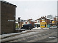
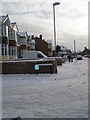
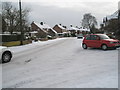
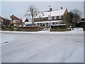


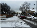

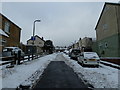
100 photos from this area
Area Information
Key information about the PO6 1PJ including its size, population, and administrative classification.
- Area Type
- Postcode
- Area Size
- 2.7 hectares
- Population
- 1597
- Population Density
- 664 people/km²
House Prices in PO6 1PJ
52
Properties
£296,869
Average Sold Price
£75,000
Lowest Price
£720,000
Highest Price
Showing 52 properties
| Address | Type | Beds | Baths | Last Sale Price | Last Sale Date | |
|---|---|---|---|---|---|---|
| 76 Station Road, Drayton And Farlington, Portsmouth, PO6 1PJ | Semi-detached | 4 | 2 | £420,000 | Mar 2025 | |
| 55 Station Road, Drayton And Farlington, Portsmouth, PO6 1PJ | Chalet | 4 | 2 | £720,000 | Mar 2025 | |
| 80 Station Road, Drayton And Farlington, Portsmouth, PO6 1PJ | Semi-detached | 2 | 1 | £335,000 | Dec 2023 | |
| 47 Station Road, Drayton And Farlington, Portsmouth, PO6 1PJ | Detached | 4 | 2 | £685,000 | Dec 2022 | |
| 34 Station Road, Drayton And Farlington, Portsmouth, PO6 1PJ | house | - | - | £325,000 | Nov 2022 | |
| 63 Station Road, Drayton And Farlington, Portsmouth, PO6 1PJ | house | - | - | £245,000 | Dec 2021 | |
| 72 Station Road, Drayton And Farlington, Portsmouth, PO6 1PJ | house | - | - | £320,250 | Jan 2021 | |
| 32 Station Road, Drayton And Farlington, Portsmouth, PO6 1PJ | Terraced | 3 | 1 | £283,000 | Oct 2020 | |
| 75 Station Road, Drayton And Farlington, Portsmouth, PO6 1PJ | Semi-detached | 3 | 1 | £260,000 | May 2019 | |
| 45 Station Road, Drayton And Farlington, Portsmouth, PO6 1PJ | Detached | 4 | 1 | £615,000 | Jul 2018 |
Page 1 of 6
Energy Efficiency in PO6 1PJ
Amenities
Schools
| Rank | School | Type | Entry gender | Ages |
|---|
Explore more schools in this area
Go to Schools tabDemographics
Household Size
Family (3-5 people)
most common
Accommodation Type
Houses
most common
Tenure
85
majority
Ethnic Group
White
most common
Religion
N/A
most common
Household Composition
N/A
most common
Age
47
median
Adults (30-64 years)
most common
Household Deprivation
N/A
with no deprivation
NS-SEC
36
in Lower managerial occupations
Explore more demographic insights in this area
Go to Demographics tabPlanning
Planning Constraints
- Flood RiskPremium
- Ramsar Wetland SitesPremium
- Area of Outstanding Natural BeautyPremium
- Protected Nature ReservePremium
- Protected WoodlandPremium