Area Overview for PO6 1NB
Photos of PO6 1NB
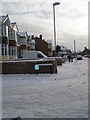
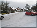
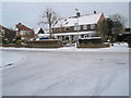
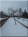
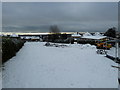
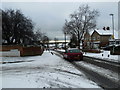
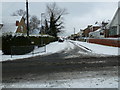
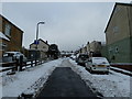
100 photos from this area
Area Information
Key information about the PO6 1NB including its size, population, and administrative classification.
- Area Type
- Postcode
- Area Size
- 1.4 hectares
- Population
- 1876
- Population Density
- 4544 people/km²
House Prices in PO6 1NB
40
Properties
£203,136
Average Sold Price
£54,000
Lowest Price
£350,000
Highest Price
Showing 40 properties
| Address | Type | Beds | Baths | Last Sale Price | Last Sale Date | |
|---|---|---|---|---|---|---|
| 48 Copsey Grove, Portsmouth, PO6 1NB | Terraced | 3 | 1 | £330,000 | Mar 2025 | |
| 8 Copsey Grove, Portsmouth, PO6 1NB | Terraced | 3 | 1 | £287,000 | Mar 2024 | |
| 6 Copsey Grove, Portsmouth, PO6 1NB | Terraced | 3 | 1 | £310,000 | May 2022 | |
| 4 Copsey Grove, Portsmouth, PO6 1NB | Terraced | 1 | 1 | £285,000 | Feb 2021 | |
| 52 Copsey Grove, Portsmouth, PO6 1NB | Terraced | 3 | 1 | £242,000 | Aug 2019 | |
| 68 Copsey Grove, Portsmouth, PO6 1NB | Terraced | 3 | 1 | £258,000 | Mar 2019 | |
| 18 Copsey Grove, Portsmouth, PO6 1NB | Terraced | 5 | 2 | £350,000 | Mar 2018 | |
| 30 Copsey Grove, Portsmouth, PO6 1NB | Terraced | 3 | 1 | £227,500 | Oct 2017 | |
| 56 Copsey Grove, Portsmouth, PO6 1NB | Terraced | 3 | 1 | £270,000 | Jun 2017 | |
| 70 Copsey Grove, Portsmouth, PO6 1NB | Terraced | 3 | 1 | £260,000 | Sep 2016 |
Page 1 of 4
Energy Efficiency in PO6 1NB
Amenities
Schools
| Rank | School | Type | Entry gender | Ages |
|---|
Explore more schools in this area
Go to Schools tabDemographics
Household Size
Family (3-5 people)
most common
Accommodation Type
Houses
most common
Tenure
76
majority
Ethnic Group
White
most common
Religion
N/A
most common
Household Composition
N/A
most common
Age
47
median
Adults (30-64 years)
most common
Household Deprivation
N/A
with no deprivation
NS-SEC
34
in Lower managerial occupations
Explore more demographic insights in this area
Go to Demographics tabPlanning
Planning Constraints
- Flood RiskPremium
- Ramsar Wetland SitesPremium
- Area of Outstanding Natural BeautyPremium
- Protected Nature ReservePremium
- Protected WoodlandPremium