Area Overview for PO6 1JJ
Photos of PO6 1JJ
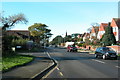
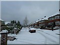
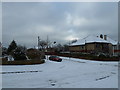
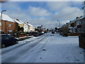
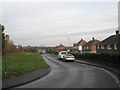
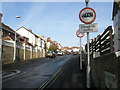
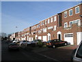
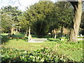
100 photos from this area
Area Information
Key information about the PO6 1JJ including its size, population, and administrative classification.
- Area Type
- Postcode
- Area Size
- 6214 m²
- Population
- 1876
- Population Density
- 4544 people/km²
House Prices in PO6 1JJ
23
Properties
£167,227
Average Sold Price
£53,000
Lowest Price
£410,000
Highest Price
Showing 23 properties
| Address | Type | Beds | Baths | Last Sale Price | Last Sale Date | |
|---|---|---|---|---|---|---|
| 51 Lower Farlington Road, Portsmouth, PO6 1JJ | house | 3 | - | £410,000 | Jan 2022 | |
| 62 Lower Farlington Road, Portsmouth, PO6 1JJ | house | - | - | £232,500 | Apr 2015 | |
| 47 Lower Farlington Road, Portsmouth, PO6 1JJ | Terraced | 3 | - | £180,000 | Apr 2014 | |
| 54 Lower Farlington Road, Portsmouth, PO6 1JJ | house | - | - | £180,000 | Oct 2012 | |
| 48 Lower Farlington Road, Portsmouth, PO6 1JJ | house | - | - | £197,500 | Dec 2011 | |
| 41 Lower Farlington Road, Portsmouth, PO6 1JJ | house | - | - | £179,995 | Aug 2005 | |
| 52 Lower Farlington Road, Portsmouth, PO6 1JJ | house | - | - | £115,000 | Jun 2002 | |
| 45 Lower Farlington Road, Portsmouth, PO6 1JJ | Terraced | - | - | £110,000 | Aug 2001 | |
| 60 Lower Farlington Road, Portsmouth, PO6 1JJ | house | 3 | - | £90,000 | Aug 2001 | |
| 37 Lower Farlington Road, Portsmouth, PO6 1JJ | Terraced | - | - | £91,500 | Jul 1999 |
Page 1 of 3
Energy Efficiency in PO6 1JJ
Amenities
Schools
| Rank | School | Type | Entry gender | Ages |
|---|
Explore more schools in this area
Go to Schools tabDemographics
Household Size
Family (3-5 people)
most common
Accommodation Type
Houses
most common
Tenure
76
majority
Ethnic Group
White
most common
Religion
N/A
most common
Household Composition
N/A
most common
Age
47
median
Adults (30-64 years)
most common
Household Deprivation
N/A
with no deprivation
NS-SEC
34
in Lower managerial occupations
Explore more demographic insights in this area
Go to Demographics tabPlanning
Planning Constraints
- Flood RiskPremium
- Ramsar Wetland SitesPremium
- Area of Outstanding Natural BeautyPremium
- Protected Nature ReservePremium
- Protected WoodlandPremium