Area Overview for PO5 4AE
Photos of PO5 4AE

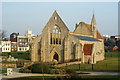

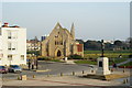
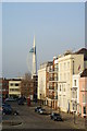
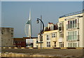
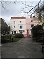
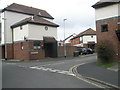
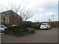
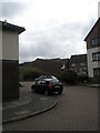
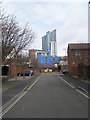
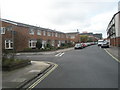
100 photos from this area
Area Information
Key information about the PO5 4AE including its size, population, and administrative classification.
- Area Type
- Postcode
- Area Size
- 2899 m²
- Population
- 1622
- Population Density
- 14652 people/km²
House Prices in PO5 4AE
15
Properties
£136,575
Average Sold Price
£120,000
Lowest Price
£170,000
Highest Price
Showing 15 properties
| Address | Type | Beds | Baths | Last Sale Price | Last Sale Date | |
|---|---|---|---|---|---|---|
| 16 St Pauls Road, Southsea, PO5 4AE | Flat | - | - | £170,000 | Jul 2021 | |
| 18 St Pauls Road, Southsea, PO5 4AE | Flat | - | - | £130,000 | Sep 2020 | |
| 10 St Pauls Road, Southsea, PO5 4AE | Flat | 3 | 1 | £160,000 | Oct 2019 | |
| 2 St Pauls Road, Southsea, PO5 4AE | Flat | - | - | £125,500 | Nov 2018 | |
| 30 St Pauls Road, Southsea, PO5 4AE | Flat | 3 | 1 | £157,000 | Jan 2017 | |
| 8 St Pauls Road, Southsea, PO5 4AE | Flat | 2 | 1 | £130,000 | Jul 2015 | |
| 14 St Pauls Road, Southsea, PO5 4AE | Flat | - | - | £126,250 | Apr 2015 | |
| 26 St Pauls Road, Southsea, PO5 4AE | Flat | 3 | 1 | £120,000 | Jul 2014 | |
| 4 St Pauls Road, Southsea, PO5 4AE | Flat | - | - | £120,000 | Nov 2011 | |
| 28 St Pauls Road, Southsea, PO5 4AE | Flat | - | - | £127,000 | Jan 2005 |
Page 1 of 2
Energy Efficiency in PO5 4AE
Amenities
Schools
| Rank | School | Type | Entry gender | Ages |
|---|
Explore more schools in this area
Go to Schools tabDemographics
Household Size
One person
most common
Accommodation Type
Flats
most common
Tenure
18
majority
Ethnic Group
White
most common
Religion
N/A
most common
Household Composition
N/A
most common
Age
22
median
Young Adults (15-29 years)
most common
Household Deprivation
N/A
with no deprivation
NS-SEC
14
in Lower managerial occupations
Explore more demographic insights in this area
Go to Demographics tabPlanning
Planning Constraints
- Flood RiskPremium
- Ramsar Wetland SitesPremium
- Area of Outstanding Natural BeautyPremium
- Protected Nature ReservePremium
- Protected WoodlandPremium