Area Overview for PO5 3NY
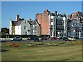
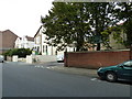
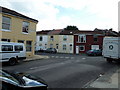
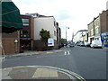
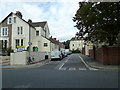
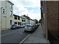
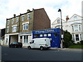
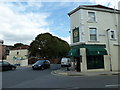
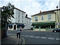
Photos of PO5 3NY


Area Information
You are looking at PO5 3NY, a small residential cluster occupying just 7807 square metres in Southsea, Hampshire. This postcode defines a tightly packed environment where the local population stands at 1948 people. The area is overwhelmingly urban, featuring a population density of 249510 people per square kilometre. This density shapes the daily rhythm of life for everyone living in PO5 3NY. Residents navigate compact streets where proximity to neighbours is the norm. The location sits at the heart of Portsmouth's housing market, offering immediate access to the coast without the isolation often found in rural properties. Living in PO5 3NY means embracing a city-centre lifestyle where amenities are walking distance. You will find yourself surrounded by the activity of Southsea, with the Spithead waterfront and Gun Wharf formed by the very nature of the settlement. This postcode area represents a specific slice of the city where space is at a premium but connectivity remains high. It is not a sprawling suburb, but a concentrated urban pocket. For anyone considering this location, the sheer compactness defines the experience. You must consider whether you thrive in high-density living or require larger plots of land that this area simply cannot offer. The sheer statistics reflect a community built on density rather than spaciousness.
- Area Type
- Postcode
- Area Size
- 7807 m²
- Population
- 1948
- Population Density
- 2592 people/km²
The property market in PO5 3NY is defined by its density and the dominance of rental stock. With only 44% home ownership, more than half of the residents in this postcode likely rent privately or through social housing schemes. This high proportion of non-owners suggests a dynamic market where leasehold flats are the primary product. Homes in PO5 3NY are almost exclusively flats, reflecting the physical constraints of the 7807 square metre footprint. This market structure means competition for tenancies can be fierce, while buyers look for investment opportunities within this compact zone. If you are purchasing, you are entering a specific niche of Portsmouth's housing landscape where square footage is scarce. The low ownership rate also impacts community investment; fewer owners often mean different maintenance cycles compared to estate-led areas. Residents navigate a market where renting is a standard, perhaps preferred, option for many professionals working in adjacent business districts. Families considering moving need to assess whether the flat-only architecture suits their long-term plans. The small area size further pressures property values, as land for new development is virtually non-existent. You must evaluate these flats against similar stock in nearby postcodes, noting that the 44% ownership figure is a local anomaly within the broader Southsea region.
House Prices in PO5 3NY
Showing 28 properties
| Address | Type | Beds | Baths | Last Sale Price | Last Sale Date | |
|---|---|---|---|---|---|---|
| 6 Auckland Road West, Southsea, PO5 3NY | Semi-detached | 3 | 1 | £635,000 | Oct 2023 | |
| 5 Auckland Road West, Southsea, PO5 3NY | house | 6 | 3 | £525,000 | May 2014 | |
| 9 Auckland Road West, Southsea, PO5 3NY | Semi-detached | 4 | 2 | £465,000 | Oct 2011 | |
| 11A Auckland Road West, Southsea, PO5 3NY | Flat | - | - | £117,500 | Nov 2006 | |
| 10 Auckland Road West, Southsea, PO5 3NY | Semi-detached | - | - | £380,000 | Dec 2003 | |
| 1A Auckland Road West, Southsea, PO5 3NY | house | - | - | £156,700 | Jun 1998 | |
| 1 Auckland Road West, Southsea, PO5 3NY | Terraced | - | - | £142,500 | Sep 1997 | |
| The Coach House, 53 Auckland Road West, Southsea, PO5 3NY | Detached | 6 | - | £95,000 | Sep 1996 | |
| Flat 2, 15 Auckland Road West, Southsea, PO5 3NY | Flat | - | - | - | - | |
| Maisonette, 11 Auckland Road West, Southsea, PO5 3NY | Detached | 5 | - | - | - |
Energy Efficiency in PO5 3NY
Daily life in PO5 3NY is characterised by immediate access to essential amenities and leisure options. Five retail outlets sit within practical reach, including Sainsburys Southsea, Spar, and Iceland Southsea. These supermarkets supply all daily food needs without the need to travel far. Transport links are equally strong, with five rail stations offering direct connections and ferry services facilitating island travel. Portsmouth IOW Car Ferry Terminal stands as a major northern European gateway, just steps away from your doorstep. Leisure options include the Smallbrook Junction, the base for the Isle of Wight Steam Railway, adding a historical travel dimension to the area. Retail diversity is limited to these specific large formats, so specialist shopping requires a trip to broader Southsea or Portsmouth city centre. Despite the small footprint of 7807 square metres, convenience is high because these major retailers are accessible within a short walk. You will find groceries, fresh produce, and household essentials readily available. The presence of multiple transport nodes means you can catch a train to work or a ferry to holiday shortly after leaving your home. Living in PO5 3NY offers a streamlined routine where errands and journeys happen quickly. You spend less time commuting and more time enjoying the proximity of established commercial hubs. This accessibility defines the convenience of life in this specific postcode cluster.
Amenities
Schools
| Rank | School | Type | Entry gender | Ages |
|---|
Explore more schools in this area
Go to Schools tabDemographics
The community within PO5 3NY has a clear demographic profile shaped by urban living conditions. The median age sits precisely at 47 years, indicating a mature resident base. Most common age groups are adults between 30 and 64 years, suggesting a stable household structure rather than a youth-dominated zone. Only 44% of residents own their homes, which implies a significant portion of the population rents their accommodation. This statistic is crucial for understanding the financial dynamics of living in PO5 3NY. The area predominantly consists of flats, aligning with the high accommodation type data provided. This layout suits singles, couples, and small families who prioritise access to town centres over large green spaces. While the most predominant ethnic group is White, the high density and urban nature suggest a diverse mix of professionals and families seeking coastal city living. Deprivation levels are not explicitly reported in the provided metrics, yet the high population density and flat-dominated stock often correlate with specific rental and ownership pressures. Anyone viewing homes in PO5 3NY should prepare for a market where renting competes strongly with outright ownership. The age profile means local schools may skew towards secondary education or accommodate older students moving into the independent phase. You will find a community that has settled in, with fewer transient young households compared to other Southsea postcodes.
Household Size
Accommodation Type
Tenure
Ethnic Group
Religion
Household Composition
Age
Household Deprivation
NS-SEC
Explore more demographic insights in this area
Go to Demographics tabPlanning
Planning Constraints
- Flood RiskPremium
- Ramsar Wetland SitesPremium
- Area of Outstanding Natural BeautyPremium
- Protected Nature ReservePremium
- Protected WoodlandPremium