Area Overview for PO5 3LD
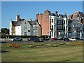
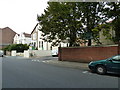
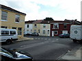
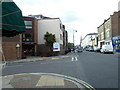
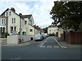
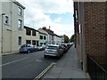
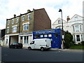
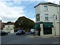
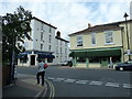
Photos of PO5 3LD


Area Information
Living in PO5 3LD means residing within a very compact residential cluster on the Hampshire coast. This postcode covers a small population of just 1,814 people, creating a tight-knit settlement close to Portsmouth Harbour. You are situated in a location defined by its proximity to major transport links rather than expansive green spaces. The village sits near the Southsea Hoverport and Portsmouth & Southsea Railway Station, which shapes the daily rhythm for everyone here. Daily life centres on practical access to the seafront and the city centre, with a distinct lack of private housing stock dominating the landscape. You will find yourself surrounded by an environment where the boundary between residential living and commercial activity is thin. This is a place chosen for convenience rather than privacy, perfect for those who prioritise transport access over a quiet, secluded garden.
- Area Type
- Postcode
- Area Size
- Not available
- Population
- 1814
- Population Density
- 16491 people/km²
The property market in PO5 3LD is defined by a shortage of standalone houses. Flats represent the predominant accommodation type, meaning buyers looking for a traditional detached home with a front garden will face immediate challenges. With home ownership rates sitting at just 33%, the area functions largely as a rental hub or a location for shared ownership schemes. You are unlikely to find a large stock of owner-occupied family homes here. Instead, the market is driven by investment potential and affordability compared to other parts of Southsea or the Isle of Wight. Buyers seeking a property must adapt to living in a high-rise or block setting rather than a semi-detached house on a cul-de-sac. This concentration of flats impacts noise levels and community governance, as residents often share common walls and entry points.
House Prices in PO5 3LD
No properties found in this postcode.
Energy Efficiency in PO5 3LD
Residents of PO5 3LD benefit from a dense network of amenities located within walking distance. You have access to five retail venues including Spar, Tesco Southsea, and Sainsburys Southsea, ensuring you can grab groceries without leaving the city limits. Transport options are extensive, with پنج rail stations serving the area, including the Portsmouth & Southsea Railway Station and the Southsea Hoverport for ferry connections to the Isle of Wight. Furthermore, five ferry terminals provide direct links to the mainland, capitalising on the area's coastal position. Leisure options include the only local metro-style attraction, the Smallbrook Junction operated by the Isle of Wight Steam Railway. This blend of supermarkets and transport hubs creates a self-sufficient living environment where daily errands are simple and swift.
Amenities
Schools
Families considering PO5 3LD have one independent school option in their immediate vicinity: Portsmouth High School. This private institution stands out as the primary educational choice for those who can afford independent education fees. For residents requiring state education, the nearest comprehensive schools will be located in the wider Southsea area rather than within this specific postcode boundary. The presence of a single independent school highlights the specialised nature of the area, catering to those seeking alternative education paths. The limited number of schools immediately nearby means you will need to commute further afield for primary or secondary state schooling. This scarcity options forces families to evaluate travel times to other established complexes in Portsmouth when planning their moves.
| Rank | School | Type | Entry gender | Ages |
|---|
Explore more schools in this area
Go to Schools tabDemographics
The community of PO5 3LD is overwhelmingly composed of adults, with the vast majority of residents falling between the ages of 30 and 64. The median age for this population is 47 years, reflecting a distinctly older demographic typical of coastal areas near military bases. This age profile suggests a neighbourhood where families with young children are less common than households in their mid-life stages. Home ownership stands at relatively low levels, with only 33% of residents owning their properties outright. This indicates that a significant portion of the 1,814 inhabitants likely rent their accommodation. The accommodation type reveals a clear preference for flats, which aligns with the high population density and smaller household units characteristic of this postcode. The predominant ethnic group is White, which matches the broader makeup of Portsmouth and the South Hampshire region.
Household Size
Accommodation Type
Tenure
Ethnic Group
Religion
Household Composition
Age
Household Deprivation
NS-SEC
Explore more demographic insights in this area
Go to Demographics tabPlanning
Planning Constraints
- Flood RiskPremium
- Ramsar Wetland SitesPremium
- Area of Outstanding Natural BeautyPremium
- Protected Nature ReservePremium
- Protected WoodlandPremium