Area Overview for PO5 3DG
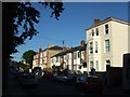
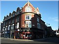
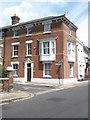
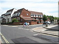
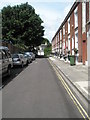
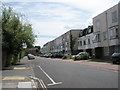
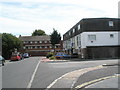
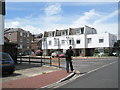
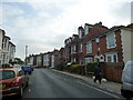
Photos of PO5 3DG


Area Information
Living in PO5 3DG offers a distinct experience defined by its status as a specific residential postcode cluster rather than a broad neighbourhood. This area covers just 466 square metres and houses a population of 1,613 people. Such a compact footprint creates a hyper-local community where residents interact frequently. The density here is exceptionally high, registering at 3,457,670 people per square kilometre according to current records. You will find that daily life revolves tightly around this small geographic pocket. The area functions as a concentrated residential zone, potentially serving as part of the larger Portsea Island landscape. Its small scale distinguishes it from surrounding suburbs that spread over larger land areas. For those seeking a defined living space, PO5 3DG presents a focused option. The sheer concentration of residents in such a tiny area suggests a environment where local services are accessed immediately or just beyond the postcode boundary. You should note when viewing homes that this code represents a micro-community within the wider PO5 region. The character of living here is shaped by these tight physical boundaries and the immediate proximity to nearby hubs like Portsmouth. This area serves as a specific node within the island's residential network.
- Area Type
- Postcode
- Area Size
- 466 m²
- Population
- 1613
- Population Density
- 11546 people/km²
The property market in PO5 3DG is dominated by flats, which constitute the primary accommodation type in this small area. This structural choice is a direct response to the 466 square metre total size of the postcode. With only 37% of residents owning their homes, you are looking at a market where rental availability is substantial. A low ownership rate often signals an area popular with investors, temporary workers, or those who cannot afford to buy locally. Within this tight postcode, property values may vary based on floor level and orientation in the flats. The high population density of 3,457,670 people per square kilometre further constrains new build potential. You will find limited space for change or expansion compared to larger suburban locations. The mix of ownership suggests competition between buy-to-let landlords and local professionals seeking to establish roots. Buyers should expect prices to reflect the scarcity of flats in such a dense cluster. The area does not appear tailored for large family houses due to the flat housing stock. Instead, it caters to singles, couples, or small household units that fit the smaller average footprint.
House Prices in PO5 3DG
Showing 9 properties
| Address | Type | Beds | Baths | Last Sale Price | Last Sale Date | |
|---|---|---|---|---|---|---|
| 3, Wilton Exchange, Pelham Road, Southsea, PO5 3DG | Flat | - | - | £159,253 | Mar 2025 | |
| 5, Wilton Exchange, Pelham Road, Southsea, PO5 3DG | Flat | - | - | £159,885 | Mar 2025 | |
| 8, Wilton Exchange, Pelham Road, Southsea, PO5 3DG | Flat | - | - | £135,000 | Feb 2025 | |
| 4, Wilton Exchange, Pelham Road, Southsea, PO5 3DG | Flat | - | - | £161,621 | Jan 2025 | |
| 9, Wilton Exchange, Pelham Road, Southsea, PO5 3DG | Flat | - | - | £165,000 | Mar 2023 | |
| 7, Wilton Exchange, Pelham Road, Southsea, PO5 3DG | Flat | - | - | £175,000 | Oct 2022 | |
| 2, Wilton Exchange, Pelham Road, Southsea, PO5 3DG | Flat | 2 | 1 | £133,000 | Mar 2021 | |
| 1, Wilton Exchange, Pelham Road, Southsea, PO5 3DG | Flat | 3 | 1 | £150,000 | Aug 2005 | |
| 6, Wilton Exchange, Pelham Road, Southsea, PO5 3DG | Flat | - | - | £150,000 | Apr 2005 |
Energy Efficiency in PO5 3DG
The lifestyle in PO5 3DG benefits from immediate access to essential retail and transport hubs. Five retail options surround the area, including specific venues like Tesco Southsea and The Southern Co-operative Co-op FR. You will find everyday grocery needs met without a long journey. Transport links are extensive, featuring five railway nodes nearby such as Portsmouth & Southsea Railway Station and Fratton Railway Station. These stations facilitate easy travel to the mainland and other parts of the UK. Ferry connectivity presents further opportunities, with five terminal options including Portsmouth IOW Car Ferry Terminal. You can reach the Isle of Wight or other coastal destinations quickly. A single metro option, the Smallbrook Junction on the Isle of Wight Steam Railway, adds a leisure rail dimension. These five categories of amenities create a convenient circle for residents. The proximity to transport ensures you are never stranded if public services run late. Shopping runs are short and efficient. Commuting times are reasonable given the closeness of Portsmouth stations. This level of accessibility defines the practical experience of living in PO5 3DG.
Amenities
Schools
| Rank | School | Type | Entry gender | Ages |
|---|
Explore more schools in this area
Go to Schools tabDemographics
The community within PO5 3DG displays a mature demographic profile with a median age of 47 years. Adults between 30 and 64 years represent the most common age range for residents in this postcode. This age distribution influences the local demand for amenities, prioritising convenience and established living over youthful growth spaces. Household composition reflects a blend of owners and renters, with home ownership standing at 37%. Consequently, you will encounter a significant rental sector alongside owner-occupied properties. This balance often characterises urban fringe or specific island zones where investment and long-term residence mix. The predominant ethnic group in PO5 3DG is White, aligning with broader southern England patterns. The local accommodation type consists primarily of flats. This structural preference indicates a high-rise or block-style living environment designed to maximise the limited land available within the 466 square metre footprint. With a population of 1,613, the shared experience of flat living fosters a communal atmosphere. Families and couples make up the bulk of households given the age data. The lack of young children or elderly-specific data suggests a standard working-age focused household mix.
Household Size
Accommodation Type
Tenure
Ethnic Group
Religion
Household Composition
Age
Household Deprivation
NS-SEC
Explore more demographic insights in this area
Go to Demographics tabPlanning
Planning Constraints
- Flood RiskPremium
- Ramsar Wetland SitesPremium
- Area of Outstanding Natural BeautyPremium
- Protected Nature ReservePremium
- Protected WoodlandPremium