Area Overview for PO5 2LL
Photos of PO5 2LL
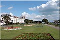
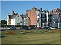
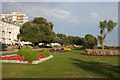

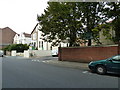
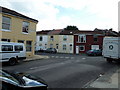
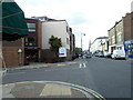
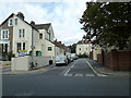
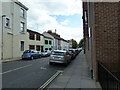
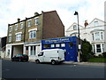
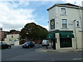
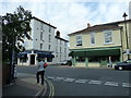
100 photos from this area
Area Information
Key information about the PO5 2LL including its size, population, and administrative classification.
- Area Type
- Postcode
- Area Size
- 1874 m²
- Population
- 1637
- Population Density
- 9686 people/km²
House Prices in PO5 2LL
13
Properties
£250,477
Average Sold Price
£118,000
Lowest Price
£320,000
Highest Price
Showing 13 properties
| Address | Type | Beds | Baths | Last Sale Price | Last Sale Date | |
|---|---|---|---|---|---|---|
| 21A Richmond Road, Southsea, PO5 2LL | Flat | 1 | 1 | £118,000 | Apr 2022 | |
| 5 Richmond Road, Southsea, PO5 2LL | Semi-detached | 2 | 1 | £290,000 | Feb 2022 | |
| 3 Richmond Road, Southsea, PO5 2LL | house | 3 | - | £319,750 | May 2020 | |
| 15 Richmond Road, Southsea, PO5 2LL | Terraced | 3 | 1 | £220,000 | Oct 2019 | |
| 19 Richmond Road, Southsea, PO5 2LL | Terraced | 2 | 1 | £272,500 | Aug 2019 | |
| 1 Richmond Road, Southsea, PO5 2LL | Terraced | 3 | 2 | £315,000 | Nov 2018 | |
| 17 Richmond Road, Southsea, PO5 2LL | Semi-detached | 3 | 2 | £320,000 | Jul 2017 | |
| 9 Richmond Road, Southsea, PO5 2LL | Terraced | 3 | - | £319,995 | May 2017 | |
| 13 Richmond Road, Southsea, PO5 2LL | Terraced | - | - | £180,000 | Dec 2014 | |
| 7 Richmond Road, Southsea, PO5 2LL | Terraced | - | - | £230,000 | Dec 2007 |
Page 1 of 2
Energy Efficiency in PO5 2LL
Amenities
Schools
| Rank | School | Type | Entry gender | Ages |
|---|
Explore more schools in this area
Go to Schools tabDemographics
Household Size
One person
most common
Accommodation Type
Flats
most common
Tenure
40
majority
Ethnic Group
White
most common
Religion
N/A
most common
Household Composition
N/A
most common
Age
47
median
Adults (30-64 years)
most common
Household Deprivation
N/A
with no deprivation
NS-SEC
36
in Lower managerial occupations
Explore more demographic insights in this area
Go to Demographics tabPlanning
Planning Constraints
- Flood RiskPremium
- Ramsar Wetland SitesPremium
- Area of Outstanding Natural BeautyPremium
- Protected Nature ReservePremium
- Protected WoodlandPremium