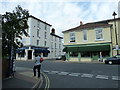
Area Overview for PO5 2DT
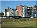
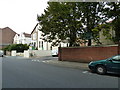
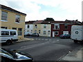
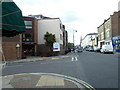
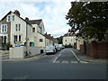
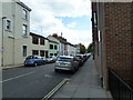
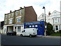
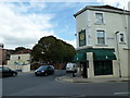
Photos of PO5 2DT


Area Information
Living in PO5 2DT means residing within a very specific residential cluster in Portsmouth, England. This postcode covers a total area of 172 square metres of dense development with a recorded population of 1,637 people. The environment is defined by its high density, with a population density figure reaching 9,520,213 people per square kilometre. Such a metric indicates极度紧凑的居住环境,where individual dwellings are in close proximity to one another. You will find a community focused on apartment-style living rather than detached housing. The setting offers immediate access to the broader Southsea area, placing you steps away from major transport hubs and retail locations. Daily life here involves navigating a compact neighbourhood where convenience relies on being within walking or cycling distance of essentials. The area functions as a distinct node within the larger Portsmouth urban fabric, catering primarily to tenants and buyers seeking flats in a central location. While the space is finite, the integration with nearby infrastructure means you trade garden space for connectivity to the city's wider amenities. Understanding this scale helps frame what to expect from property values, noise levels, and community interactions in PO5 2DT.
- Area Type
- Postcode
- Area Size
- 172 m²
- Population
- 1637
- Population Density
- 9686 people/km²
The property market in PO5 2DT is characterised by a significant rental component, as only 40% of residents are homeowners. This statistic indicates that the majority of housing stock is available to private renters or sits within the social housing sector. Flats are the primary accommodation type here, meaning buyers looking for spacious, detached houses with land will find limited inventory within this specific postcode. The housing stock consists mainly of smaller residential units designed for high-density living. Given the low home ownership rate, capital growth driven by first-time buyers purchasing terraced homes is less likely than in suburban areas. Prospective buyers must consider whether a flat in PO5 2DT matches their need for communal living or proximity to the city centre. Investors might find appeal in areas with high rental turnover, while owner-occupiers should look toward the 40% ownership segment for potential stability. The nature of the stock implies a market focused on convenience and location rather than extensive outdoor space or privacy. Understanding this split is essential for anyone assessing investment potential or considering where to build an equity base.
House Prices in PO5 2DT
No properties found in this postcode.
Energy Efficiency in PO5 2DT
Your daily lifestyle in PO5 2DT is supported by a dense concentration of amenities within walking or short driving distance. Retail choices include Tesco Southsea, Waitrose Southsea, and Iceland Southsea, giving you access to major supermarkets and specialty grocery stores. For commuters and visitors, transport options are robust, with five rail connections near Southsea and Portsmouth Harbour Station Pier. Ferries operate from Portsmouth IOW Car Ferry Terminal and Portsmouth Millenium Pontoon, linking you directly to the Isle of Wight and mainland Europe. A single metro point exists at Smallbrook Junction, offering a nostalgic rail experience via the Isle of Wight Steam Railway. This mix of modern commerce, regular public transport, and heritage attractions creates a versatile environment. You can shop for freshproduce at Waitrose, catch a train at The Portsmouth & Southsea Railway Station, or board a ferry at the Harbour Station Pier. The variety ensures you do not need a car for most errands, though ownership remains useful for accessing wider attractions.
Amenities
Schools
Families living in or near PO5 2DT should consider two specific independent schools for education. St John's College operates as an independent institution and offers a private education option close to the postcode. Yago School Uk Limited also functions as an independent school, providing another private educational choice within easy reach of the neighbourhood. Neither school is listed as state-funded, so parents seeking free education must look beyond these immediate options. The presence of two independent schools suggests that high-net-worth families may choose to reside slightly further out to secure places at these institutions. There is no data on the number of state primary or secondary schools directly adjacent to PO5 2DT in the provided information. Consequently, families reliant on the state system must check local authority catchment areas outside this specific cluster. The independence of the listed schools means that attendance is typically subject to fees and entry exams rather than geographic zoning alone.
| Rank | School | Type | Entry gender | Ages |
|---|
Explore more schools in this area
Go to Schools tabDemographics
The community in PO5 2DT is dominated by adults between the ages of 30 and 64, who make up the most common age group. The median age for residents is 47 years old, reflecting a mature demographic that has settled into this postcode. Household composition shows that 40% of residents own their homes, while the remaining majority live in rented accommodation. Flats form the predominant accommodation type, aligning with the demographic trend of older adults living inマンション-style developments. Ethnically, the population is predominantly White, contributing to a relatively homogenous local community. There is no specific statistical data provided regarding deprivation levels within this text, so reliance on general quality of life factors is necessary when evaluating the area. The age profile suggests a neighbourhood where long-term residents likely outnumber people moving for work, creating a stable social fabric. With a median age near 47, families with young children are less common than empty-nester households or couples. This demographic reality influences local business offerings and community events, which tend to cater to adult interests rather than young families.
Household Size
Accommodation Type
Tenure
Ethnic Group
Religion
Household Composition
Age
Household Deprivation
NS-SEC
Explore more demographic insights in this area
Go to Demographics tabPlanning
Planning Constraints
- Flood RiskPremium
- Ramsar Wetland SitesPremium
- Area of Outstanding Natural BeautyPremium
- Protected Nature ReservePremium
- Protected WoodlandPremium