Area Overview for PO5 1NJ
Photos of PO5 1NJ
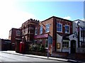
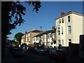
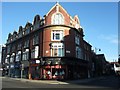
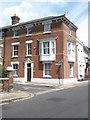
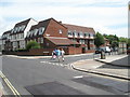
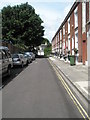
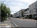
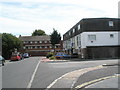
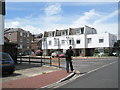
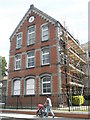
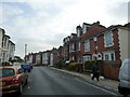
100 photos from this area
Area Information
Key information about the PO5 1NJ including its size, population, and administrative classification.
- Area Type
- Postcode
- Area Size
- 7232 m²
- Population
- 1629
- Population Density
- 13712 people/km²
House Prices in PO5 1NJ
52
Properties
£305,243
Average Sold Price
£85,000
Lowest Price
£598,750
Highest Price
Showing 52 properties
| Address | Type | Beds | Baths | Last Sale Price | Last Sale Date | |
|---|---|---|---|---|---|---|
| 84 Chelsea Road, Southsea, PO5 1NJ | Terraced | 3 | 1 | £598,750 | Dec 2025 | |
| 8 Chelsea Road, Southsea, PO5 1NJ | Terraced | 3 | 2 | £460,000 | Nov 2025 | |
| 58 Chelsea Road, Southsea, PO5 1NJ | house | 3 | 1 | £540,000 | Mar 2025 | |
| 20 Chelsea Road, Southsea, PO5 1NJ | Terraced | 2 | 2 | £420,000 | Oct 2024 | |
| 52 Chelsea Road, Southsea, PO5 1NJ | Semi-detached | 4 | 5 | £540,000 | Mar 2024 | |
| 26 Chelsea Road, Southsea, PO5 1NJ | house | - | - | £460,000 | Nov 2022 | |
| 6 Chelsea Road, Southsea, PO5 1NJ | Terraced | 3 | 2 | £415,000 | Apr 2021 | |
| 28 Chelsea Road, Southsea, PO5 1NJ | house | - | - | £380,000 | Mar 2021 | |
| 12 Chelsea Road, Southsea, PO5 1NJ | Terraced | 3 | 2 | £415,000 | Dec 2020 | |
| 44 Chelsea Road, Southsea, PO5 1NJ | house | - | - | £335,000 | Feb 2020 |
Page 1 of 6
Energy Efficiency in PO5 1NJ
Amenities
Schools
| Rank | School | Type | Entry gender | Ages |
|---|
Explore more schools in this area
Go to Schools tabDemographics
Household Size
One person
most common
Accommodation Type
Houses
most common
Tenure
46
majority
Ethnic Group
White
most common
Religion
N/A
most common
Household Composition
N/A
most common
Age
47
median
Adults (30-64 years)
most common
Household Deprivation
N/A
with no deprivation
NS-SEC
38
in Lower managerial occupations
Explore more demographic insights in this area
Go to Demographics tabPlanning
Planning Constraints
- Flood RiskPremium
- Ramsar Wetland SitesPremium
- Area of Outstanding Natural BeautyPremium
- Protected Nature ReservePremium
- Protected WoodlandPremium