Area Overview for PO5 1AZ
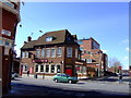
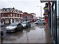
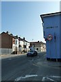
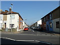
Photos of PO5 1AZ


Area Information
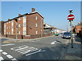
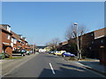
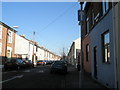
Living in PO5 1AZ means residing in a tightly defined residential cluster within Portsmouth, England. This specific postcode covers a small population of 1,959 people, creating a contained community where daily routines are often dictated by proximity to immediate local services. You are situated in a distinct pocket of the city where the rhythm of life is shaped by the surrounding transport hubs and retail outlets. The area functions as a specific node within the broader PO5 postcode, offering a sense of locality that larger residential zones often lack. Daily life here revolves around practical access rather than expansive green spaces or sprawling infrastructure. Residents navigate a landscape dominated by flats, which dictates the physical character of the neighbourhood. Your view will likely look towards flat roofs and communal courtyards rather than manicured gardens. The area sits close to major railway lines and ferry terminals, meaning your commute or travel plans to the Isle of Wight are immediately linked to this specific postal address. You live in a zone defined by its density and direct connections to Portsmouth International Cruise & Ferry Terminal and Fratton Railway Station. This context shapes the noise levels, foot traffic, and general atmosphere you experience every day.
- Area Type
- Postcode
- Area Size
- Not available
- Population
- 1959
- Population Density
- 9528 people/km²
The property market in PO5 1AZ is characterised by a specific alignment between housing stock and residents. With flats comprising the predominant accommodation type, the local market is heavily weighted towards multi-occupancy dwellings rather than detached family houses. This configuration naturally leads to a rental landscape where only 16% of the population owns their homes. For buyers looking at this small area, the primary inventory will consist of apartments and purpose-built flats rather than semi-detached or terraced houses. When searching for homes in PO5 1AZ, you will find options that suit single occupants or small households. The high proportion of rentals suggests that much of the housing stock is managed by letting agencies or building societies rather than individual owners keen to sell. This dynamic can affect the price elasticity you might experience when buying freehold properties, as the supply of owner-occupied stock is scarce. If you are considering a purchase, you must look closely at the specific layout of the flats, as design quality can vary significantly within this specific postcode. The market is not driven by family growth spurts but by lifestyle-renters and older adults downsizing into flats. This means competition for properties may shift based on tenant requirements for communal amenities or elevator access rather than garden space. You might find that the best value lies in securing a long-term leasehold agreement which allows you to establish tenure in this unique residential cluster. The limited scale of the area means that property sales data is more niche, requiring focused attention on the specific building blocks that house the 1,959 residents.
House Prices in PO5 1AZ
No properties found in this postcode.
Energy Efficiency in PO5 1AZ
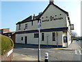
Life in PO5 1AZ offers immediate access to a wide variety of amenities that are essential for daily routines. Retail options are plentiful within your practical reach, with five notable supermarkets operating close by. You can shop at Asda Portsmouth, Farmfoods Fratton, and The Southern Co-operative Co without needing a long journey. These stores provide everything from fresh produce to general household goods, making the area highly convenient for weekly shopping. Transport and leisure facilities are similarly integrated into your lifestyle. Five major transport nodes serve the immediate vicinity, ensuring you can catch trains or ferries without significant travel time. Portsmouth & Southsea Railway Station and Fratton Railway Station are key highlights for daily commuting. For those with maritime interests, the Southsea Hoverport, Portsmouth International Cruise & Ferry Terminal, and Portsmouth IOW Car Ferry Terminal are all nearby. This density of transport infrastructure means you can access the wider region with ease. The specific mix of amenities does not include parks or leisure centres in the provided data, so your local leisure activities centre around the large retail parks and busier transport hubs. Asda Portsmouth and Farmfoods Fratton often host community events and provide ample space for stacking your car. If you require dedicated leisure facilities, they are likely located within the immediate trade area of these major retailers. The lifestyle here is utilitarian, prioritising convenience and accessibility over quiet countryside retreats.
Amenities
Schools
For families considering PO5 1AZ, the educational landscape is narrowly defined by immediate proximity. There is one primary school listed near this postcode: St John's Cathedral Catholic Primary School. This institution holds a Good Ofsted rating, which is a reassuring metric for parents evaluating their options. The absence of secondary schools or other primary institutions within the immediate data set means families must rely on this single facility or look further afield to PO5 1AZ. The concentration of a single primary school suggests a specific catchment area that may draw students from slightly beyond the immediate residential cluster. Living in PO5 1AZ means you would be reliant on this one rated school for primary education, which simplifies your choice but limits your alternatives if the catchment boundaries change. You should verify the current catchment area maps before purchasing to ensure the house falls within the operating zone for St John's Cathedral Catholic Primary School. While there are no other schools listed for this specific postcode, the good rating of the available primary option is a positive practical factor. The diversity in school types is non-existent within the provided data, which points to a strong dependence on this single provider. Families must prioritise distance to St John's Cathedral Catholic Primary School when viewing homes near PO5 1AZ. The small population of 1,959 ensures that the school rolls will be modest compared to larger urban parishes.
| Rank | School | Type | Entry gender | Ages |
|---|
Explore more schools in this area
Go to Schools tabDemographics
The community in PO5 1AZ is defined by a mature demographic profile. The median age stands at 47 years, indicating that Adults aged 30 to 64 years form the most common age range within the population. This suggests a neighbourhood where working professionals and individuals in mid-life dominate the household structure. You are not in an area driven by young families or students; the residents are likely established in their careers and personal lives. Home ownership in this specific cluster remains relatively low, with only 16% of residents owning their homes outright. This statistic points towards a high concentration of renters rather than owner-occupiers. The prevailing accommodation type is flats, which aligns with the rental-heavy nature of the area. This housing stock appeals to those seeking lower entry costs who prefer living without the responsibility of maintenance or large Garden plots. The resident population is predominantly White, reflecting the broader diversity patterns often seen in Portsmouth but reinforced here by the limited scale of the postcode area. The lack of single-family detached homes means the social fabric is built around shared living spaces and communal areas rather than private gardens. This environment suits those who value urban living and are less reliant on curbside parking. The demographic pressure is low given the small population size, meaning you will engage with a consistent group of neighbours who have been in the area for some time. The age profile implies a stable community with fewer transient young households moving through quickly.
Household Size
Accommodation Type
Tenure
Ethnic Group
Religion
Household Composition
Age
Household Deprivation
NS-SEC
Explore more demographic insights in this area
Go to Demographics tabPlanning
Planning Constraints
- Flood RiskPremium
- Ramsar Wetland SitesPremium
- Area of Outstanding Natural BeautyPremium
- Protected Nature ReservePremium
- Protected WoodlandPremium