Area Overview for PO41 0TS
Photos of PO41 0TS


Area Information
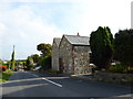
Living in PO41 0TS means inhabiting a specific residential cluster covering 9.6 hectares on the Isle of Wight. This postcode serves a population of 1,260 people, creating a tightly knit community where neighbours know each other well. The area is intimate in scale, offering a quiet residential experience rather than the bustle of a town centre. Population density sits at 65 people per square kilometre, indicating spacious surroundings and limited overcrowding. You will find a neighbourhood defined by its housing clusters rather than high-rise blocks or large commercial developments. Daily life revolves around the immediate vicinity, with most residents relying on local facilities and established routines. The setting attracts those seeking a quieter pace of living while maintaining access to essential services nearby. Houses dominate the landscape, reflecting a traditional housing pattern typical of this coastal location. The area functions as a stable residential zone, providing a defined home environment for families and individuals alike.
- Area Type
- Postcode
- Area Size
- 9.6 hectares
- Population
- 1260
- Population Density
- 65 people/km²
Homes in PO41 0TS are characterised by a clear shift towards owner-occupier status. The home ownership rate reaches 82 per cent, meaning fewer than one in five households rents. This stationary housing market suggests that properties are often bought with an eye towards long-term living rather than investment flips. The accommodation type is exclusively houses, which aligns with the demographic data showing a mature population. You are unlikely to encounter purpose-built flats or high-density blocks in this specific postcode. The market operates on a consistent basis where buyers expect to classify the property as a home rather than a temporary residence. This dynamic often stabilises property values and fosters a buyer-driven environment. Prospective purchasers should understand that entering this market involves competing with owners rather than landlords. The high ownership rate generally correlates with lower tenant turnover and a more traditional residential atmosphere.
House Prices in PO41 0TS
No properties found in this postcode.
Energy Efficiency in PO41 0TS
Daily life in PO41 0TS relies on a small number of nearby amenities within practical reach of residents. Retail options are limited but practical, with five key locations available. Residents can shop at the Tesco Isle of Wight store for groceries, Sainsburys Freshwater for additional food choices, and The Southern Co-operative Co for local necessities. Yarmouth IOW Ferry Terminal serves as the primary ferry connection for residents looking to travel between the mainland and the Isle of Wight. This terminal is essential for accessing broader services outside the immediate postcode. The area does not feature extensive high streets or leisure complexes, meaning you will plan visits to these specific spots for weekly runs or longer trips. Shopping trips require travel to these points, adding a layer of activity to your routine. The layout forces residents to engage with the wider Isle of Wight network for major retail and leisure activities.
Amenities
Schools
Schools near PO41 0TS offer limited but reliable options for families living in the immediate postcode. Shalfleet Church of England Primary School stands as the sole educational institution listed within practical reach of the area. This primary school holds a good Ofsted rating, which indicates strong educational standards and suitable learning environments. The absence of secondary schools or high schools within the immediate vicinity means that local primary education is the main provision for younger children. Families residing here must consider transport links or catchment boundaries to reach secondary education elsewhere on the island. The presence of a single primary school suggests a quiet academic environment without the intense competition found in larger towns. Parents in PO41 0TS rely on this specific institution for early years education. The good rating provides reassurance for those prioritising educational quality in their home selection decisions.
| Rank | School | Type | Entry gender | Ages |
|---|
Explore more schools in this area
Go to Schools tabDemographics
The community in PO41 0TS reflects a mature demographic profile with a median age of 47 years. The most common age range comprises adults between 30 and 64 years, suggesting a population that has already settled into their careers and families. Home ownership stands at an impressive 82 per cent, indicating that the vast majority of residents have purchased their properties rather than renting. This high rate of ownership points to a stable community where people put down roots and stay long-term. Houses are the predominant accommodation type, aligning with the suburban nature of the postcode. White residents form the predominant ethnic group within the neighbourhood. The area lacks the transient nature of student hubs or rental-heavy zones, fostering a sense of established permanence. Buyers looking for a settled community will find this area fits their criteria for long-term residence. The age profile suggests a lack of very young children, though families with school-age children remain a significant part of the population.
Household Size
Accommodation Type
Tenure
Ethnic Group
Religion
Household Composition
Age
Household Deprivation
NS-SEC
Explore more demographic insights in this area
Go to Demographics tabPlanning
Planning Constraints
- Flood RiskPremium
- Ramsar Wetland SitesPremium
- Area of Outstanding Natural BeautyPremium
- Protected Nature ReservePremium
- Protected WoodlandPremium
- Crime RiskPremium