Area Overview for PO40 9ED
Photos of PO40 9ED

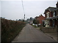
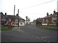
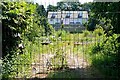
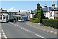
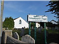
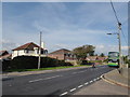

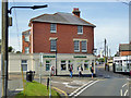
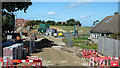
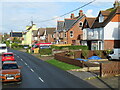
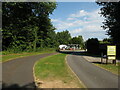
32 photos from this area
Area Information
Key information about the PO40 9ED including its size, population, and administrative classification.
- Area Type
- Postcode
- Area Size
- 9085 m²
- Population
- 1513
- Population Density
- 2889 people/km²
House Prices in PO40 9ED
32
Properties
£195,344
Average Sold Price
£36,000
Lowest Price
£332,500
Highest Price
Showing 32 properties
| Address | Type | Beds | Baths | Last Sale Price | Last Sale Date | |
|---|---|---|---|---|---|---|
| 3, Princes Court, Princes Road, Freshwater, PO40 9ED | house | - | - | £215,000 | Feb 2022 | |
| Lyndhurst Villa, Princes Road, Freshwater, PO40 9ED | Semi-detached | 4 | - | £332,500 | Sep 2021 | |
| 2, Princes Court, Princes Road, Freshwater, PO40 9ED | house | - | - | £195,000 | May 2021 | |
| Ocean Breeze, Princes Road, Freshwater, PO40 9ED | Semi-detached | 3 | 1 | £218,000 | Dec 2020 | |
| Westfield, Princes Road, Freshwater, PO40 9ED | Detached | 3 | 2 | £225,000 | Sep 2020 | |
| The Orchards, Princes Road, Freshwater, PO40 9ED | Detached | 4 | 4 | £320,000 | Mar 2020 | |
| 4, Princes Court, Princes Road, Freshwater, PO40 9ED | Terraced | 3 | 1 | £205,000 | May 2019 | |
| Mayfield, Princes Road, Freshwater, PO40 9ED | house | - | - | £142,000 | Apr 2016 | |
| The Croft, Princes Road, Freshwater, PO40 9ED | house | - | - | £176,000 | Sep 2015 | |
| Cartref, Princes Road, Freshwater, PO40 9ED | Semi-detached | 3 | - | £178,000 | Apr 2015 |
Page 1 of 4
Energy Efficiency in PO40 9ED
Amenities
Schools
| Rank | School | Type | Entry gender | Ages |
|---|
Explore more schools in this area
Go to Schools tabDemographics
Household Size
Two person
most common
Accommodation Type
Houses
most common
Tenure
68
majority
Ethnic Group
White
most common
Religion
N/A
most common
Household Composition
N/A
most common
Age
47
median
Adults (30-64 years)
most common
Household Deprivation
N/A
with no deprivation
NS-SEC
27
in Lower managerial occupations
Explore more demographic insights in this area
Go to Demographics tabPlanning
Planning Constraints
- Flood RiskPremium
- Ramsar Wetland SitesPremium
- Area of Outstanding Natural BeautyPremium
- Protected Nature ReservePremium
- Protected WoodlandPremium
- Crime RiskPremium