Area Overview for PO4 9SH
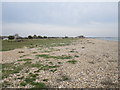
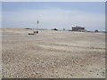
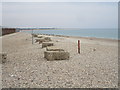
Photos of PO4 9SH


Area Information
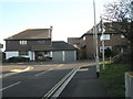
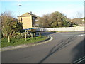
Living in PO4 9SH offers a quiet residential experience within a specific postcode cluster of England. This small residential area hosts a population of 1,435 people, creating a compact community where neighbours know each other. The location sits near Portsmouth, providing easy access to coastal life while maintaining a distinct neighbourhood identity. Residents here enjoy a setting defined by its low density and residential focus. The area functions as a peaceful base for those seeking stability away from high-rise urban centres. Daily life centres around local streets and connections to nearby transport hubs rather than a busy high street directly on the doorsteps. The character of PO4 9SH is defined by its established nature and lack of major planning constraints such as protected landscapes or flood risks. This stability makes it an attractive option for families and individuals looking to put down roots. The housing stock consists primarily of houses, which aligns with the typical profile of this demographic. You will find a established environment where the built form prioritises privacy and garden space. The area avoids significant environmental hazards, offering a clear line of sight to the future without planning uncertainties. It is a place where the focus remains on home ownership and community stability rather than transient living.
- Area Type
- Postcode
- Area Size
- Not available
- Population
- 1435
- Population Density
- 4115 people/km²
The property market in PO4 9SH is characterised by a strong preference for owner-occupied homes. With 69% of households owning their homes, the area functions as a solid investment zone rather than a transient rental market. This statistic reflects a community where residents have committed to long-term stays and have the financial means to purchase property. The accommodation type consists primarily of houses, meaning you will find detached, semi-detached, or terraced family dwellings rather than flats or apartments. This housing stock supports a lifestyle that includes gardens and separate living spaces, appealing to families and professionals seeking quiet. Buying a home in PO4 9SH aligns with the wishes of the majority of current residents. The market lacks the volatility often found in student-led or high rental yield areas. Instead, values are likely driven by the enduring demand for houses in stable neighbourhoods. This dominance of owner-occupiers creates a consistent market where sellers are often motivated by life changes rather than financial pressure. For a buyer looking at this position, the environment feels secure and predictable. The composition of the housing stock ensures that the area maintains its residential character without the noise and density associated with rental-heavy districts.
House Prices in PO4 9SH
No properties found in this postcode.
Energy Efficiency in PO4 9SH
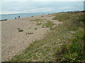
Daily life in PO4 9SH is supported by a convenient network of nearby amenities located within practical reach. You have five retail options to choose from, including well-known chains such as Tesco Cumberland and The Southern Co-operative Co. These supermarkets provide essential shopping needs without the need for a long daily drive. Five ferry landings also serve as nearby amenities, including the Portsmouth International Cruise & Ferry Terminal, which adds a leisure dimension beyond simple transport. You can book excursions to the New Forest or Scottish ports easily from this location. For those who travel by train, Fratton Railway Station and Portsmouth & Southsea Railway Station are key transport hubs that double as social meeting points. The Southsea Hoverport offers a unique waterfront experience for residents. While PO4 9SH itself is primarily residential, these surrounding facilities provide a robust support system. You can purchase groceries, meet friends at local cafeterias, or plan weekend trips via the ferry network. The proximity of The Southern Co-operative Co ensures you have reliable access to fresh produce and household goods. This balance of essential retail and leisure transport options creates a convenient lifestyle where you do not need to drive far for most daily needs.
Amenities
Schools
| Rank | School | Type | Entry gender | Ages |
|---|
Explore more schools in this area
Go to Schools tabDemographics
The community in PO4 9SH reflects a settled and mature neighbourhood with a median age of 47 years. Most residents fall into the adult age range between 30 and 64 years, indicating a populace that has established careers and families. This demographic profile suggests an area driven by stability, where residents value long-term tenancy and home ownership. You will find a predominantly White ethnic group forming the majority of the population, consistent with the broader Hampshire region. Home ownership stands at a high level of 69%, which means the vast majority of households own their property outright or with a mortgage. This high ownership rate contrasts sharply with national rental averages and signals a market where buying is the norm rather than renting. The accommodation type is almost exclusively houses, providing spacious living environments with private outdoor areas. This setup suits families and professionals who prioritise space and resident privacy over the convenience of apartments. The low proportion of younger households under 30 suggests the area is not a prime location for first-time buyers entering the market, but rather for those with established financial footing. The community feels cohesive and established, with long-term residents likely shaping the local culture and decision-making processes.
Household Size
Accommodation Type
Tenure
Ethnic Group
Religion
Household Composition
Age
Household Deprivation
NS-SEC
Explore more demographic insights in this area
Go to Demographics tabPlanning
Planning Constraints
- Flood RiskPremium
- Ramsar Wetland SitesPremium
- Area of Outstanding Natural BeautyPremium
- Protected Nature ReservePremium
- Protected WoodlandPremium