Area Overview for PO4 9JZ
Photos of PO4 9JZ
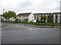
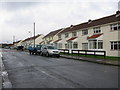
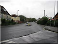
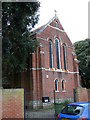
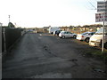
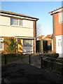
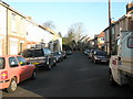
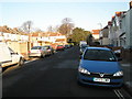
100 photos from this area
Area Information
Key information about the PO4 9JZ including its size, population, and administrative classification.
- Area Type
- Postcode
- Area Size
- 8519 m²
- Population
- 1435
- Population Density
- 4115 people/km²
House Prices in PO4 9JZ
30
Properties
£223,126
Average Sold Price
£72,500
Lowest Price
£355,000
Highest Price
Showing 30 properties
| Address | Type | Beds | Baths | Last Sale Price | Last Sale Date | |
|---|---|---|---|---|---|---|
| 43 Bransbury Road, Southsea, PO4 9JZ | house | - | - | £340,000 | Mar 2022 | |
| 32 Bransbury Road, Southsea, PO4 9JZ | Terraced | 3 | 1 | £280,632 | Aug 2021 | |
| 21 Bransbury Road, Southsea, PO4 9JZ | Terraced | 3 | 2 | £355,000 | Mar 2020 | |
| 40 Bransbury Road, Southsea, PO4 9JZ | house | 3 | - | £265,000 | Aug 2017 | |
| 39 Bransbury Road, Southsea, PO4 9JZ | Terraced | 3 | 1 | £260,000 | Jun 2017 | |
| 27 Bransbury Road, Southsea, PO4 9JZ | house | - | - | £177,500 | Apr 2013 | |
| 37 Bransbury Road, Southsea, PO4 9JZ | Terraced | - | - | £162,500 | Aug 2003 | |
| 34 Bransbury Road, Southsea, PO4 9JZ | Terraced | - | - | £95,000 | Jun 2002 | |
| 23 Bransbury Road, Southsea, PO4 9JZ | house | - | - | £72,500 | Aug 1998 | |
| 28 Bransbury Road, Southsea, PO4 9JZ | house | - | - | - | - |
Page 1 of 3
Energy Efficiency in PO4 9JZ
Amenities
Schools
| Rank | School | Type | Entry gender | Ages |
|---|
Explore more schools in this area
Go to Schools tabDemographics
Household Size
Two person
most common
Accommodation Type
Houses
most common
Tenure
69
majority
Ethnic Group
White
most common
Religion
N/A
most common
Household Composition
N/A
most common
Age
47
median
Adults (30-64 years)
most common
Household Deprivation
N/A
with no deprivation
NS-SEC
36
in Lower managerial occupations
Explore more demographic insights in this area
Go to Demographics tabPlanning
Planning Constraints
- Flood RiskPremium
- Ramsar Wetland SitesPremium
- Area of Outstanding Natural BeautyPremium
- Protected Nature ReservePremium
- Protected WoodlandPremium