Area Overview for PO4 9AY
Photos of PO4 9AY
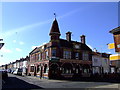
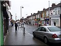
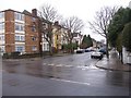
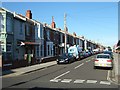
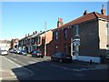
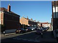
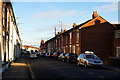
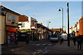
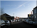
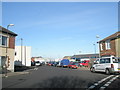
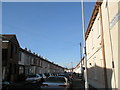
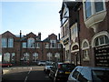
100 photos from this area
Area Information
Key information about the PO4 9AY including its size, population, and administrative classification.
- Area Type
- Postcode
- Area Size
- 6948 m²
- Population
- 1727
- Population Density
- 13203 people/km²
House Prices in PO4 9AY
41
Properties
£252,734
Average Sold Price
£45,000
Lowest Price
£481,500
Highest Price
Showing 41 properties
| Address | Type | Beds | Baths | Last Sale Price | Last Sale Date | |
|---|---|---|---|---|---|---|
| 73 Hunter Road, Southsea, PO4 9AY | Terraced | 2 | 1 | £253,000 | Sep 2025 | |
| 61 Hunter Road, Southsea, PO4 9AY | Terraced | 3 | 1 | £362,000 | Feb 2025 | |
| 52 Hunter Road, Southsea, PO4 9AY | Terraced | 4 | 2 | £425,000 | Feb 2025 | |
| 60 Hunter Road, Southsea, PO4 9AY | Terraced | 3 | 1 | £370,000 | Dec 2024 | |
| 46 Hunter Road, Southsea, PO4 9AY | Terraced | 3 | 1 | £410,000 | Dec 2023 | |
| 49 Hunter Road, Southsea, PO4 9AY | Terraced | 4 | 2 | £481,500 | Aug 2022 | |
| 45 Hunter Road, Southsea, PO4 9AY | Terraced | 4 | - | £455,000 | Nov 2021 | |
| 37 Hunter Road, Southsea, PO4 9AY | house | - | - | £380,000 | Jun 2021 | |
| 48 Hunter Road, Southsea, PO4 9AY | house | - | - | £320,000 | Jun 2021 | |
| 53 Hunter Road, Southsea, PO4 9AY | house | 4 | - | £320,000 | Mar 2021 |
Page 1 of 5
Energy Efficiency in PO4 9AY
Amenities
Schools
| Rank | School | Type | Entry gender | Ages |
|---|
Explore more schools in this area
Go to Schools tabDemographics
Household Size
One person
most common
Accommodation Type
Houses
most common
Tenure
56
majority
Ethnic Group
White
most common
Religion
N/A
most common
Household Composition
N/A
most common
Age
47
median
Adults (30-64 years)
most common
Household Deprivation
N/A
with no deprivation
NS-SEC
33
in Lower managerial occupations
Explore more demographic insights in this area
Go to Demographics tabPlanning
Planning Constraints
- Flood RiskPremium
- Ramsar Wetland SitesPremium
- Area of Outstanding Natural BeautyPremium
- Protected Nature ReservePremium
- Protected WoodlandPremium