Area Overview for PO4 9AA
Photos of PO4 9AA
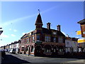
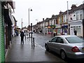
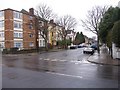
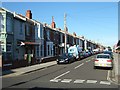
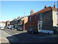
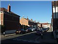
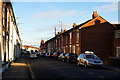
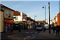
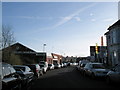
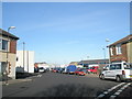
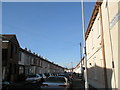
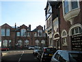
100 photos from this area
Area Information
Key information about the PO4 9AA including its size, population, and administrative classification.
- Area Type
- Postcode
- Area Size
- 1.2 hectares
- Population
- 1727
- Population Density
- 13203 people/km²
House Prices in PO4 9AA
67
Properties
£223,667
Average Sold Price
£40,000
Lowest Price
£380,000
Highest Price
Showing 67 properties
| Address | Type | Beds | Baths | Last Sale Price | Last Sale Date | |
|---|---|---|---|---|---|---|
| 61 St Augustine Road, Southsea, PO4 9AA | Terraced | 3 | 1 | £294,000 | Sep 2025 | |
| 99 St Augustine Road, Southsea, PO4 9AA | Terraced | 4 | 2 | £295,000 | Dec 2024 | |
| 121 St Augustine Road, Southsea, PO4 9AA | Terraced | 3 | 1 | £312,000 | Dec 2024 | |
| 81 St Augustine Road, Southsea, PO4 9AA | Terraced | 3 | 1 | £347,000 | Nov 2024 | |
| 33 St Augustine Road, Southsea, PO4 9AA | Terraced | 3 | 1 | £322,500 | Sep 2024 | |
| 11 St Augustine Road, Southsea, PO4 9AA | Terraced | 3 | 1 | £275,000 | Aug 2024 | |
| 73 St Augustine Road, Southsea, PO4 9AA | Terraced | 3 | 1 | £267,500 | Feb 2024 | |
| 49 St Augustine Road, Southsea, PO4 9AA | Terraced | 3 | 1 | £320,000 | Jun 2023 | |
| 85 St Augustine Road, Southsea, PO4 9AA | Terraced | 5 | 2 | £320,000 | Jan 2023 | |
| 125 St Augustine Road, Southsea, PO4 9AA | Terraced | 3 | 1 | £380,000 | Jan 2023 |
Page 1 of 7
Energy Efficiency in PO4 9AA
Amenities
Schools
| Rank | School | Type | Entry gender | Ages |
|---|
Explore more schools in this area
Go to Schools tabDemographics
Household Size
One person
most common
Accommodation Type
Houses
most common
Tenure
56
majority
Ethnic Group
White
most common
Religion
N/A
most common
Household Composition
N/A
most common
Age
47
median
Adults (30-64 years)
most common
Household Deprivation
N/A
with no deprivation
NS-SEC
33
in Lower managerial occupations
Explore more demographic insights in this area
Go to Demographics tabPlanning
Planning Constraints
- Flood RiskPremium
- Ramsar Wetland SitesPremium
- Area of Outstanding Natural BeautyPremium
- Protected Nature ReservePremium
- Protected WoodlandPremium