Area Overview for PO4 8QQ
Photos of PO4 8QQ


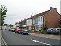
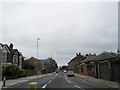
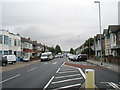
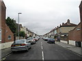
100 photos from this area
Area Information
Key information about the PO4 8QQ including its size, population, and administrative classification.
- Area Type
- Postcode
- Area Size
- 4072 m²
- Population
- 1419
- Population Density
- 1963 people/km²
House Prices in PO4 8QQ
39
Properties
£93,617
Average Sold Price
£60,000
Lowest Price
£120,000
Highest Price
Showing 39 properties
| Address | Type | Beds | Baths | Last Sale Price | Last Sale Date | |
|---|---|---|---|---|---|---|
| 7, Brent Court, Warren Avenue, Southsea, PO4 8QQ | Flat | - | - | £85,000 | Mar 2025 | |
| 6, Brent Court, Warren Avenue, Southsea, PO4 8QQ | Flat | 1 | 1 | £86,250 | Apr 2024 | |
| 4, Brent Court, Warren Avenue, Southsea, PO4 8QQ | Flat | - | - | £120,000 | Aug 2022 | |
| 21, Brent Court, Warren Avenue, Southsea, PO4 8QQ | Flat | 1 | 1 | £83,000 | Feb 2022 | |
| 25, Brent Court, Warren Avenue, Southsea, PO4 8QQ | Flat | - | - | £119,000 | Oct 2021 | |
| 34, Brent Court, Warren Avenue, Southsea, PO4 8QQ | Flat | - | - | £80,000 | Aug 2021 | |
| 26, Brent Court, Warren Avenue, Southsea, PO4 8QQ | Flat | - | - | £117,375 | Sep 2020 | |
| 28, Brent Court, Warren Avenue, Southsea, PO4 8QQ | Flat | - | - | £112,500 | Mar 2019 | |
| 31, Brent Court, Warren Avenue, Southsea, PO4 8QQ | Flat | 1 | 1 | £82,500 | Dec 2018 | |
| 30, Brent Court, Warren Avenue, Southsea, PO4 8QQ | Flat | 1 | 1 | £77,500 | Mar 2018 |
Page 1 of 4
Energy Efficiency in PO4 8QQ
Amenities
Schools
| Rank | School | Type | Entry gender | Ages |
|---|
Explore more schools in this area
Go to Schools tabDemographics
Household Size
Two person
most common
Accommodation Type
Houses
most common
Tenure
78
majority
Ethnic Group
White
most common
Religion
N/A
most common
Household Composition
N/A
most common
Age
47
median
Adults (30-64 years)
most common
Household Deprivation
N/A
with no deprivation
NS-SEC
33
in Lower managerial occupations
Explore more demographic insights in this area
Go to Demographics tabPlanning
Planning Constraints
- Flood RiskPremium
- Ramsar Wetland SitesPremium
- Area of Outstanding Natural BeautyPremium
- Protected Nature ReservePremium
- Protected WoodlandPremium