Area Overview for PO4 8LX
Photos of PO4 8LX
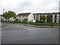
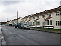
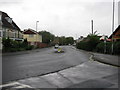
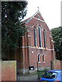
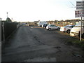
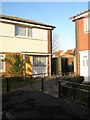
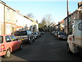
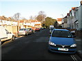
100 photos from this area
Area Information
Key information about the PO4 8LX including its size, population, and administrative classification.
- Area Type
- Postcode
- Area Size
- 2599 m²
- Population
- 1114
- Population Density
- 2026 people/km²
House Prices in PO4 8LX
13
Properties
£177,700
Average Sold Price
£45,995
Lowest Price
£251,000
Highest Price
Showing 13 properties
| Address | Type | Beds | Baths | Last Sale Price | Last Sale Date | |
|---|---|---|---|---|---|---|
| 14 Meryl Road, Southsea, PO4 8LX | Terraced | 2 | 1 | £240,000 | Jul 2024 | |
| 1 Meryl Road, Southsea, PO4 8LX | Retail | 3 | 1 | £251,000 | Mar 2022 | |
| 2 Meryl Road, Southsea, PO4 8LX | Terraced | 2 | 1 | £245,000 | May 2021 | |
| 8 Meryl Road, Southsea, PO4 8LX | Terraced | 2 | 1 | £205,000 | Mar 2020 | |
| 6 Meryl Road, Southsea, PO4 8LX | Terraced | 2 | - | £200,000 | Jan 2017 | |
| 12 Meryl Road, Southsea, PO4 8LX | Terraced | 2 | 1 | £163,000 | Jul 2014 | |
| 4 Meryl Road, Southsea, PO4 8LX | house | 2 | - | £142,500 | Aug 2013 | |
| 7 Meryl Road, Southsea, PO4 8LX | Bungalow | 2 | - | £179,500 | Jan 2012 | |
| 5 Meryl Road, Southsea, PO4 8LX | Terraced | - | - | £105,000 | May 2002 | |
| 10 Meryl Road, Southsea, PO4 8LX | Terraced | - | - | £45,995 | Jul 1997 |
Page 1 of 2
Energy Efficiency in PO4 8LX
Amenities
Schools
| Rank | School | Type | Entry gender | Ages |
|---|
Explore more schools in this area
Go to Schools tabDemographics
Household Size
One person
most common
Accommodation Type
Houses
most common
Tenure
63
majority
Ethnic Group
White
most common
Religion
N/A
most common
Household Composition
N/A
most common
Age
47
median
Adults (30-64 years)
most common
Household Deprivation
N/A
with no deprivation
NS-SEC
31
in Lower managerial occupations
Explore more demographic insights in this area
Go to Demographics tabPlanning
Planning Constraints
- Flood RiskPremium
- Ramsar Wetland SitesPremium
- Area of Outstanding Natural BeautyPremium
- Protected Nature ReservePremium
- Protected WoodlandPremium