Area Overview for PO4 8JH
Photos of PO4 8JH
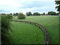
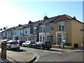
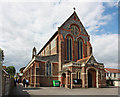

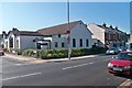


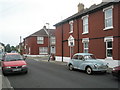
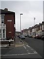
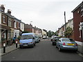
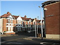
100 photos from this area
Area Information
Key information about the PO4 8JH including its size, population, and administrative classification.
- Area Type
- Postcode
- Area Size
- 5549 m²
- Population
- 1507
- Population Density
- 9133 people/km²
House Prices in PO4 8JH
34
Properties
£175,775
Average Sold Price
£70,000
Lowest Price
£270,000
Highest Price
Showing 34 properties
| Address | Type | Beds | Baths | Last Sale Price | Last Sale Date | |
|---|---|---|---|---|---|---|
| 22 Weston Avenue, Southsea, PO4 8JH | Terraced | 3 | 1 | £270,000 | Jul 2025 | |
| 3 Weston Avenue, Southsea, PO4 8JH | Terraced | 3 | 1 | £260,000 | Feb 2025 | |
| 24 Weston Avenue, Southsea, PO4 8JH | house | - | - | £255,000 | Jul 2021 | |
| 7 Weston Avenue, Southsea, PO4 8JH | Terraced | 3 | 1 | £212,000 | Feb 2020 | |
| 30 Weston Avenue, Southsea, PO4 8JH | Terraced | 3 | 1 | £225,000 | Sep 2019 | |
| 10 Weston Avenue, Southsea, PO4 8JH | Terraced | 3 | 1 | £238,000 | Jul 2019 | |
| 14 Weston Avenue, Southsea, PO4 8JH | Terraced | 3 | 1 | £236,000 | Apr 2018 | |
| 20 Weston Avenue, Southsea, PO4 8JH | Terraced | 3 | 1 | £228,000 | Oct 2017 | |
| 16 Weston Avenue, Southsea, PO4 8JH | house | 3 | 1 | £225,000 | May 2017 | |
| 28 Weston Avenue, Southsea, PO4 8JH | Detached | 3 | 2 | £162,000 | Aug 2012 |
Page 1 of 4
Energy Efficiency in PO4 8JH
Amenities
Schools
| Rank | School | Type | Entry gender | Ages |
|---|
Explore more schools in this area
Go to Schools tabDemographics
Household Size
Family (3-5 people)
most common
Accommodation Type
Houses
most common
Tenure
72
majority
Ethnic Group
White
most common
Religion
N/A
most common
Household Composition
N/A
most common
Age
47
median
Adults (30-64 years)
most common
Household Deprivation
N/A
with no deprivation
NS-SEC
35
in Lower managerial occupations
Explore more demographic insights in this area
Go to Demographics tabPlanning
Planning Constraints
- Flood RiskPremium
- Ramsar Wetland SitesPremium
- Area of Outstanding Natural BeautyPremium
- Protected Nature ReservePremium
- Protected WoodlandPremium