Area Overview for PO4 8DB
Photos of PO4 8DB
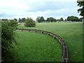
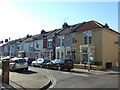
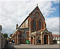

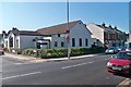


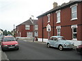
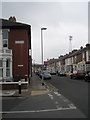
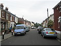
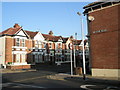
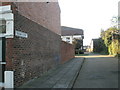
100 photos from this area
Area Information
Key information about the PO4 8DB including its size, population, and administrative classification.
- Area Type
- Postcode
- Area Size
- 9436 m²
- Population
- 1481
- Population Density
- 12969 people/km²
House Prices in PO4 8DB
63
Properties
£211,651
Average Sold Price
£48,000
Lowest Price
£379,995
Highest Price
Showing 63 properties
| Address | Type | Beds | Baths | Last Sale Price | Last Sale Date | |
|---|---|---|---|---|---|---|
| 68 Teddington Road, Southsea, PO4 8DB | Terraced | 3 | 1 | £300,000 | Mar 2025 | |
| 41 Teddington Road, Southsea, PO4 8DB | Terraced | 3 | 1 | £332,000 | May 2024 | |
| 52 Teddington Road, Southsea, PO4 8DB | Terraced | 3 | 1 | £265,000 | Mar 2024 | |
| 28 Teddington Road, Southsea, PO4 8DB | Terraced | 3 | 1 | £310,000 | Oct 2023 | |
| 45 Teddington Road, Southsea, PO4 8DB | Terraced | 3 | 1 | £305,000 | Aug 2023 | |
| 23 Teddington Road, Southsea, PO4 8DB | Terraced | 4 | 1 | £307,000 | Aug 2023 | |
| 16 Teddington Road, Southsea, PO4 8DB | Terraced | 3 | 1 | £312,500 | Jun 2023 | |
| 36 Teddington Road, Southsea, PO4 8DB | Terraced | 3 | 1 | £337,500 | Apr 2023 | |
| 12 Teddington Road, Southsea, PO4 8DB | Terraced | 3 | 1 | £293,000 | Mar 2023 | |
| 72 Teddington Road, Southsea, PO4 8DB | Terraced | 3 | 1 | £325,000 | Feb 2023 |
Page 1 of 7
Energy Efficiency in PO4 8DB
Amenities
Schools
| Rank | School | Type | Entry gender | Ages |
|---|
Explore more schools in this area
Go to Schools tabDemographics
Household Size
Family (3-5 people)
most common
Accommodation Type
Houses
most common
Tenure
74
majority
Ethnic Group
White
most common
Religion
N/A
most common
Household Composition
N/A
most common
Age
47
median
Adults (30-64 years)
most common
Household Deprivation
N/A
with no deprivation
NS-SEC
45
in Lower managerial occupations
Explore more demographic insights in this area
Go to Demographics tabPlanning
Planning Constraints
- Flood RiskPremium
- Ramsar Wetland SitesPremium
- Area of Outstanding Natural BeautyPremium
- Protected Nature ReservePremium
- Protected WoodlandPremium