Area Overview for PO4 0DG
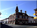
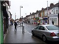
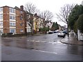
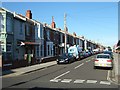
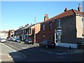
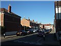
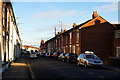
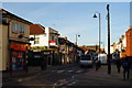
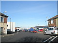
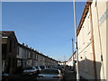
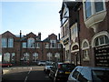
Photos of PO4 0DG

Area Information
Living in PO4 0DG means residing in a small, specific residential cluster that covers just 509 square metres. This compact postcode serves 1,883 residents, creating a tightly knit environment where daily life moves quickly. The area is situated in England, functioning as a defined point within the wider post town structure rather than a sprawling district. For those seeking a precise location, this cluster offers a clear identity without the vastness of larger neighbourhoods. The population density is a defining characteristic of this space, resulting in a very concentrated community. You will find yourself in an environment where proximity is the key factor in your daily routine. The area functions as a distinct residential node, separate from broader urban sprawl yet connected to major transport arteries nearby. Daily life here involves navigating a small footprint that efficiently houses nearly 1,900 people. This density ensures that amenities and services are within a short walk, reducing the need for lengthy commutes across the town. The character of PO4 0DG is immediate and focused, offering a straightforward living experience for those who value defined boundaries. It is a place where the local geography dictates the pace of life, blending residential comfort with the practicalities of high-density urban living in a postcode-specific zone.
- Area Type
- Postcode
- Area Size
- 509 m²
- Population
- 1883
- Population Density
- 17244 people/km²
The property market in PO4 0DG is shaped significantly by the fact that houses form the predominant accommodation type in the area. With only 42% of residents owning their homes, this postcode leans towards a mixed market with a strong presence of rental properties. This statistic suggests that while you can find houses to buy, there is also substantial availability for those looking to rent or join shared living arrangements. The small area size of 509 square metres combined with a population of 1,883 people indicates a high density environment. You will likely encounter a housing stock composed mainly of houses, unlike urban areas where flats might dominate due to space constraints. This composition offers specific benefits for buyers seeking detached or semi-detached properties within a compact zone. The lower home ownership rate implies that the market may respond well to first-time buyers entering the property ladder. Families looking for traditional house layouts will find this area suitable, given the primary accommodation type. However, the 58% rental rate suggests a competitive market for tenants as well as a dynamic entry point for purchasers. When evaluating homes in PO4 0DG, consider that the stock is traditional rather than modern conversions, fitting the stated preference for houses in this specific postcode. This balance of ownership and rental, set within a high-density cluster, creates a specific dynamic unique to this small residential section.
House Prices in PO4 0DG
Showing 34 properties
| Address | Type | Beds | Baths | Last Sale Price | Last Sale Date | |
|---|---|---|---|---|---|---|
| Unit 25, Jcl Halls, 151 Fawcett Road, Southsea, PO4 0DG | Unknown | - | - | - | - | |
| Unit 34, Jcl Halls, 151 Fawcett Road, Southsea, PO4 0DG | Unknown | - | - | - | - | |
| Flat 14, Jcl Halls, 151 Fawcett Road, Southsea, PO4 0DG | Flat | - | - | - | - | |
| Flat 15, Jcl Halls, 151 Fawcett Road, Southsea, PO4 0DG | Flat | - | - | - | - | |
| Unit 27, Jcl Halls, 151 Fawcett Road, Southsea, PO4 0DG | Unknown | - | - | - | - | |
| Unit 31, Jcl Halls, 151 Fawcett Road, Southsea, PO4 0DG | Unknown | - | - | - | - | |
| Flat 13, Jcl Halls, 151 Fawcett Road, Southsea, PO4 0DG | Flat | - | - | - | - | |
| Flat 18, Jcl Halls, 151 Fawcett Road, Southsea, PO4 0DG | Flat | - | - | - | - | |
| Flat 17, Jcl Halls, 151 Fawcett Road, Southsea, PO4 0DG | Flat | - | - | - | - | |
| Flat 19, Jcl Halls, 151 Fawcett Road, Southsea, PO4 0DG | Flat | - | - | - | - |
Energy Efficiency in PO4 0DG
Your daily life in PO4 0DG is supported by a cluster of accessible amenities within practical reach. For shopping needs, you can visit The Southern Co-operative Co and Tesco Albert, which are noted as the five retail options nearby. These supermarkets provide essential groceries and daily necessities without requiring a long drive into the city centre. Transport connections are robust, with five notable rail facilities located close by, including Fratton Railway Station, Portsmouth & Southsea Railway Station, and Southsea Hoverport. From these stations, you can access broader travel networks quickly. Ferry travel is also convenient, as the Portsmouth IOW Car Ferry Terminal, Portsmouth Millennium Pontoon, and Portsmouth Harbour Station Pier are all within easy reach. These ferry terminals connect residents to the Isle of Wight and other coastal destinations. This proximity to rail and ferry hubs means you can travel further afield easily for leisure or business. The availability of these specific transport points integrates seamlessly into your weekly routine. You will have the flexibility to reach Portsmouth and beyond using the Portsmouth & Southsea Railway Station or the ferry options. This density of transport and retail options makes PO4 0DG a well-connected hub for residents who value convenience and accessibility in their lifestyle choices.
Amenities
Schools
Families living in PO4 0DG will find several educational options available within a practical commuting distance. Bramble Infant School and Nursery is a primary institution located near the area, and it holds a 'good' Ofsted rating from the education authority. This specific rating indicates that the school meets the expected standards for quality education and care. In addition to primary care, The Brambles Nursery School and Children's Centre offers nursery education, supporting younger children before they start formal schooling at Bramble Infant School. These two facilities provide a continuous support system from early years through to primary education. You will not find secondary schools listed in the immediate vicinity of PO4 0DG based on the current data, so prospective parents should factor in a commute for older children. The presence of a 'good' rated primary school is a positive factor for families residing or looking to move to this postcode. This mix of nurseries and a specific primary school with a formal rating ensures that early childhood development needs are met locally. For households with young children, the proximity of The Brambles Nursery School and children's centre adds convenience to daily routines. When planning an education strategy, relying on the confirmed 'good' rating of Bramble Infant School and Nursery provides a solid foundation for your family's schooling plans in this specific community.
| Rank | School | Type | Entry gender | Ages |
|---|
Explore more schools in this area
Go to Schools tabDemographics
The community in PO4 0DG is defined by its youthful demographic, with a median age of only 22 years. Most common age residents fall into the 15 to 29 years bracket, indicating that many households are likely occupied by young adults starting their lives. Within this group, you will see a mix of those moving into independent living or shared accommodation. Home ownership stands at 42%, suggesting that a significant portion of residents are renting or living with family members rather than owning their properties outright. The predominant ethnic group in the area is White, forming the majority of the population profile. Houses are the main accommodation type listed for this postcode, providing traditional residential housing within the small cluster. You will not find a high level of ethnic diversity according to the current figures, which points to a largely homogenous community. This age profile often correlates with a dynamic social scene driven by students and early career professionals. The high concentration of young people naturally shapes the local economy towards services suited to this specific age group. Living here means joining an area where social life likely revolves around nightlife, university proximity, or early career networking. The demographic data paints a picture of a transitional living space rather than a family-centric suburb with established long-term residents.
Household Size
Accommodation Type
Tenure
Ethnic Group
Religion
Household Composition
Age
Household Deprivation
NS-SEC
Explore more demographic insights in this area
Go to Demographics tabPlanning
Planning Constraints
- Flood RiskPremium
- Ramsar Wetland SitesPremium
- Area of Outstanding Natural BeautyPremium
- Protected Nature ReservePremium
- Protected WoodlandPremium