Area Overview for PO4 0AT
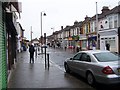
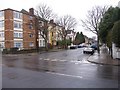
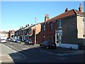
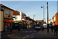
Photos of PO4 0AT


Area Information
Living in PO4 0AT means residing within a specific postcode area defined as a small residential cluster in England. This compact community forms part of the broader Portsmouth locale, offering a defined environment for those seeking a settled lifestyle. The area contains a population of 2,637 residents, creating a neighbourhood where community members likely know one another. You will find yourself in a setting that balances residential privacy with access to wider services nearby. The demographic makeup suggests a mature population, with the majority of residents falling between thirty and sixty-four years old. This age range indicates a neighbourhood populated by families and adults who have established themselves in the region. The accommodation here is dominated by houses rather than flats, suggesting a preference for detached or semi-detached living arrangements. Daily life involves straightforward access to essentials without the congestion of high-density urban zones. You are living in a space where the focus remains on stable housing and local convenience. The small size of this cluster allows for a manageable street network, meaning you can navigate your daily commute or a walk to the shops with ease. This postcode serves as a functional hub within the larger PO4 postcode district, providing security through specific boundaries while remaining connected to the surrounding transport infrastructure.
- Area Type
- Postcode
- Area Size
- Not available
- Population
- 2637
- Population Density
- 3881 people/km²
The property market in PO4 0AT is defined by a significant level of private ownership, with exactly fifty-four per cent of homes owner-occupied. This figure positions the area as a stable residential zone where residents typically hold title to their dwellings rather than renting from private landlords. Houses constitute the predominant accommodation type, meaning you will encounter traditional single-family structures rather than apartment blocks or shared flats. This housing stock suggests a layout designed for individual households seeking privacy and space. The concentration of houses aligns with the median age of forty-seven years, indicating that buyers in this market are often securing permanent homes for their families. A majority ownership rate of over fifty per cent usually implies that the local estate market relies on direct sales between individuals. Prospective homebuyers looking at this small area will find a market driven by owner-transfer rather than the rental turnover common in student suburbs. The prevalence of houses ensures that the visual character of the street remains consistent with suburban standards. This market dynamic supports long-term planning, as owners are invested in maintaining the value of their properties within the cluster. When evaluating homes in PO4 0AT, you are looking at a stock that prioritises established residency over transient living arrangements.
House Prices in PO4 0AT
No properties found in this postcode.
Energy Efficiency in PO4 0AT
Your daily lifestyle in PO4 0AT benefits from a range of amenities located within practical reach of the residential cluster. Five retail locations serve the immediate community, including Lidl Southsea, Aldi Fratton Way, and Tesco Fratton. These supermarkets provide all essential grocery needs without requiring a long journey. For commuters and international travelers, transport links are extensive. Five rail stations operate near the area, including Fratton Railway Station and Portsmouth and Southsea Railway Station, offering regular train services. Five ferry terminals are also available nearby, such as the Portsmouth International Cruise and Ferry Terminal and the Portsmouth IOW Car Ferry Terminal. This connectivity grants you quick access to the Isle of Wight and London, making the area a strategic base for travel. The presence of the Southsea Hoverport further enhances mobility options for residents who need to commute to nearby cities frequently. You do not need to drive far to access major shopping or transport hubs. The density of these five retail and five transport venues ensures convenience is always just a short drive or train ride away. Living in PO4 0AT offers the balance of a quiet residential zone with the practical benefits of being close to Portsmouth's main economic arteries. This accessibility supports a lifestyle where you can enjoy local tranquility while remaining connected to the wider world.
Amenities
Schools
| Rank | School | Type | Entry gender | Ages |
|---|
Explore more schools in this area
Go to Schools tabDemographics
The community in PO4 0AT is characterised by a clear age profile where adults between thirty and sixty-four years old represent the most common age range. With a median age of forty-seven years, the residents are disproportionately mature compared to national averages. This demographic skew reflects an area where people have settled long-term rather than a hub for students or young professionals. Exactly half of the population resides in the three-to-sixty-four year bracket, indicating a stable household structure typical of built-up residential areas. Homeownership stands at fifty-four per cent, a figure that signifies a robust market where the majority of residents own their properties outright or have significant equity. This ownership level typically supports local investment and community stability. Houses make up the primary form of accommodation, reinforcing the layout of this residential cluster. Residents belong predominantly to the White ethnic group, which aligns with the broader historical development of the Portsmouth region. You are dealing with a neighbourhood where the population is well-settled and family-oriented. The high proportion of homeowners suggests that many residents are put-down roots rather than long-term renters. This stability often translates into lower turnover rates, meaning neighbours tend to stay in their homes for extended periods. Such a community environment provides a consistent social fabric for those who value familiarity. The demographic data paints a picture of a place built for established families and older adults seeking a quiet, owned property.
Household Size
Accommodation Type
Tenure
Ethnic Group
Religion
Household Composition
Age
Household Deprivation
NS-SEC
Explore more demographic insights in this area
Go to Demographics tabPlanning
Planning Constraints
- Flood RiskPremium
- Ramsar Wetland SitesPremium
- Area of Outstanding Natural BeautyPremium
- Protected Nature ReservePremium
- Protected WoodlandPremium