Area Overview for PO39 0FG
Photos of PO39 0FG
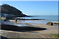
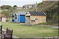
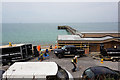
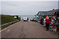
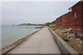
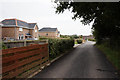

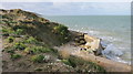
69 photos from this area
Area Information
Key information about the PO39 0FG including its size, population, and administrative classification.
- Area Type
- Postcode
- Area Size
- 1.3 hectares
- Population
- 1513
- Population Density
- 2889 people/km²
House Prices in PO39 0FG
8
Properties
£245,500
Average Sold Price
£120,000
Lowest Price
£325,000
Highest Price
Showing 8 properties
| Address | Type | Beds | Baths | Last Sale Price | Last Sale Date | |
|---|---|---|---|---|---|---|
| Weston, Ivylands Close, Totland, PO39 0FG | Semi-detached | - | - | £120,000 | Aug 2021 | |
| Easton, Ivylands Close, Totland, PO39 0FG | Semi-detached | - | - | £152,000 | May 2019 | |
| Vader Vale, Ivylands Close, Totland, PO39 0FG | Detached | - | - | £320,000 | Feb 2016 | |
| The Willows, Ivylands Close, Totland, PO39 0FG | Detached | - | - | £325,000 | Oct 2015 | |
| Parkside, Ivylands Close, Totland, PO39 0FG | Detached | - | - | £286,000 | Sep 2015 | |
| Elba, Ivylands Close, Totland, PO39 0FG | Detached | - | - | £270,000 | Sep 2015 | |
| Plot 2, Ivylands Close, Totland, PO39 0FG | house | - | - | - | - | |
| Blue House, Ivylands Close, Totland, PO39 0FG | Detached | - | - | - | - |
Energy Efficiency in PO39 0FG
Amenities
Schools
| Rank | School | Type | Entry gender | Ages |
|---|
Explore more schools in this area
Go to Schools tabDemographics
Household Size
Two person
most common
Accommodation Type
Houses
most common
Tenure
68
majority
Ethnic Group
White
most common
Religion
N/A
most common
Household Composition
N/A
most common
Age
47
median
Adults (30-64 years)
most common
Household Deprivation
N/A
with no deprivation
NS-SEC
27
in Lower managerial occupations
Explore more demographic insights in this area
Go to Demographics tabPlanning
Planning Constraints
- Flood RiskPremium
- Ramsar Wetland SitesPremium
- Area of Outstanding Natural BeautyPremium
- Protected Nature ReservePremium
- Protected WoodlandPremium
- Crime RiskPremium