Area Overview for PO36 9JH
Photos of PO36 9JH


Area Information
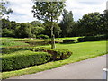
PO36 9JH is a specific postcode area located in England, covering a small residential cluster of 7.6 hectares. This compact size supports a population of 1,451 people, creating a tightly knit neighbourhood where the average density reaches 1,207 people per square kilometre. The area functions as a quiet residential hub rather than a commercial district, offering residents a liveable space that prioritises housing over sprawl. Living in PO36 9JH means you are part of a contained community where distances to local services are short, fostering a sense of familiarity among neighbours. The designated boundaries cover a consistent residential footprint, ensuring that the character of the area remains defined by domestic structures. Prospective buyers seeking a contained environment with clear limits will find this postcode offers a straightforward layout without the unpredictability of larger towns. The area's small scale translates into manageable daily commutes and easier access to immediate surroundings, making it a practical choice for those who value proximity to their home.
- Area Type
- Postcode
- Area Size
- 7.6 hectares
- Population
- 1451
- Population Density
- 1207 people/km²
Buying homes in PO36 9JH involves entering a market characterised by high owner-occupier participation. With 76 per cent of households owning their homes, the property landscape is dominated by people who have settled permanently rather than short-term tenants. The primary accommodation type available is houses, which means you will not find the high-rise flats or apartments common in urban centres. This housing stock reflects an area designed for families and individuals seeking ground-level living with garden space and privacy. The concentration of owner-occupied properties suggests a slower turnover rate compared to rental-heavy zones, which often indicates a stable price environment driven by local demand. When considering PO36 9JH as a potential base, expect to focus on traditional house styles suited to the local conservation of a residential cluster. The market here rewards buyers looking for established dwellings rather than new build developments, fitting the demographic profile of mature residents who have kept their homes for years.
House Prices in PO36 9JH
No properties found in this postcode.
Energy Efficiency in PO36 9JH
Your daily life in PO36 9JH is supported by a network of nearby amenities that are within practical reach without requiring long commutes. You have five railway stations to choose from, including Sandown Railway Station, Lake Railway Station, and Shanklin Railway Station, providing diverse options for national travel. Retail convenience is high, with five notable shops including Tesco Lake, Sainsburys Sandown, and Co-op Sandown located close by for your weekly shopping needs. For those with aviation interests or travel requirements, there are two airports nearby: the Isle of Wight / Sandown Airport and Bembridge Airport. Local leisure is accessible through five metro transport points, featuring the Isle of Wight Steam Railway and a line to Havenstreet. Additionally, two ferry terminals serve the area, namely Ryde Hoverport and Fishbourne IOW Ferry Terminal. This dense cluster of options means you do not need to leave the broader region for essential services or occasional recreation.
Amenities
Schools
Families living in PO36 9JH have access to two key educational institutions within their immediate vicinity. The nearest primary option is Sandown High School, which serves younger students in the Foundation Stage and early years. For older children and teenagers, residents can access Sandown Bay Academy, which operates as an academy. These two schools provide a direct educational pathway for families settling in the postcode area. The mix of a primary-style provision and an academy means that children do not always need to travel far to their education, reducing reliance on wider transport networks for school runs. The presence of these specific named schools confirms that educational provision is integrated closely with the residential zone. While the data does not specify Ofsted ratings for either Sandown High School or Sandown Bay Academy, their proximity ensures that PO36 9JH residents have established schools within practical reach for their own children.
| Rank | School | Type | Entry gender | Ages |
|---|
Explore more schools in this area
Go to Schools tabDemographics
The community within PO36 9JH reflects a mature demographic where adults between 30 and 64 years old are the most common age group. The median age for residents is 47, indicating a population made up largely of families or individuals in the middle stages of their lives. Home ownership is a defining feature of this neighbourhood, with 76 per cent of households owning their property. This high ownership rate suggests financial stability and long-term settlement among residents, distinguishing PO36 9JH from areas dominated by private rental markets. The predominant ethnic group in the area is White, which contributes to a culturally homogeneous environment. Most accommodation takes the form of houses, aligning with the preference for detached or semi-detstood living found in many established English neighbourhoods. These demographic facts paint a picture of a stable, established community where long-term residents form the backbone of the local social fabric.
Household Size
Accommodation Type
Tenure
Ethnic Group
Religion
Household Composition
Age
Household Deprivation
NS-SEC
Explore more demographic insights in this area
Go to Demographics tabPlanning
Planning Constraints
- Flood RiskPremium
- Ramsar Wetland SitesPremium
- Area of Outstanding Natural BeautyPremium
- Protected Nature ReservePremium
- Protected WoodlandPremium
- Crime RiskPremium