Area Overview for PO30 9AN
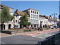
Photos of PO30 9AN


Area Information
Living in PO30 9AN offers a specific character defined by its small residential cluster within the broader Newport region. This postcode covers an area home to 1,981 people, creating a sense of locality where residents often know one another. With a population density of 386 people per square kilometre, the area feels contained yet accessible to the wider Isle of Wight. The setting is predominantly residential, focused on houses rather than high-density blocks, which contributes to a quieter daily rhythm compared to more commercial towns. You will find yourself part of a community where home ownership is the norm, reflecting long-term settlement rather than temporary renting. The location provides a practical base for accessing major transport links, including multiple railway stations and ferry terminals nearby. While the area is small, its connectivity to services like Ryde St Johns Road Railway Station and the East Cowes Ferry Terminal ensures you are not isolated. The environment avoids significant planning constraints such as protected woodlands or Ramsar wetland sites, simplifying potential future developments or structural changes to your home. Daily life here balances the convenience of being close to islands' key travel hubs with the stability of a primarily owner-occupied residential zone.
- Area Type
- Postcode
- Area Size
- Not available
- Population
- 1981
- Population Density
- 386 people/km²
The property market for homes in PO30 9AN is defined by a stock of houses with a solid majority of owner-occupied properties. With 75 per cent of the population owning their homes, the area functions primarily as an owner-occupied zone rather than a rental hotspot. This high level of ownership implies that buyers looking at properties here are usually engaging with the local market to purchase a permanent residence. The prevailing accommodation type is houses, which aligns with the demographic appeal to families and individuals seeking more space than a flat would provide. Buying in this postcode means entering a market where seller motivation may vary, but the underlying stability of resident ownership usually supports long-term investment potential. There is little indication of a transient rental sector, so you can expect a neighbourhood where residents have a vested interest in the area's upkeep. For those considering moving to this specific cluster, the market reflects a desire for established, rather than speculative, housing. You will find that most transactions involve families or empty nesters looking to consolidate or upgrade within a familiar postcode.
House Prices in PO30 9AN
No properties found in this postcode.
Energy Efficiency in PO30 9AN
Your daily lifestyle in PO30 9AN benefits from immediate access to essential retail and transport hubs within practical reach. For shopping needs, Iceland Newport, Lidl Newport, and Sainsburys Isle are all located nearby, providing convenience without the need to travel far into the city centre. Transport options are comprehensive, with five major metro points including Wootton, Smallbrook Junction, and the Isle of Wight Steam Railway at Havenstreet. You can also access two rail stations, Ryde St Johns Road Railway Station and Ryde Esplanade Railway Station, making commuting across the island straightforward. Ferry connections are equally accessible, with five nearby terminals such as the East Cowes Floating Bridge, East Cowes Ferry Terminal, and the Red Jet Ferry Terminal offering direct routes to the mainland and surrounding islands. An airport is also within reach at the Isle of Wight / Sandown Airport, providing additional travel flexibility. These amenities blend to create a location where work, leisure, and travel are all efficiently connected. You do not need a car to manage daily tasks, though ownership may still be preferable given the island's geography.
Amenities
Schools
The primary educational institution near PO30 9AN is The Isle of Wight College, which serves as a sixth-form centre. This facility provides post-16 education, making it the key educational destination for young adults and students in the immediate vicinity. While there are no primary or secondary schools listed directly within the data for this specific postcode, the presence of a sixth-form college indicates that educational provision is integrated into the region's infrastructure. For residents seeking school-age education, the nearby location of The Isle of Wight College suggests that travel to the town of Newport for A-levels orFurther education is short and manageable. The mix of school types available to you centres on further education rather than comprehensive schooling in the immediate neighbourhood. When planning for children, you must account for The Isle of Wight College as the main nearby educational option for older students. Younger families may need to look towards standard state schools in broader Newport, but the direct data only confirms the sixth-form provision at this specific educational hub.
| Rank | School | Type | Entry gender | Ages |
|---|---|---|---|---|
| 1 | The Isle of Wight College | sixth-form | N/A | N/A |
Explore more schools in this area
Go to Schools tabDemographics
The community in PO30 9AN reflects a mature demographic profile dominated by adults between the ages of 30 and 64 years. The median age stands at 47, indicating that families and established households form the core of the population. This age structure suggests a neighbourhood where people have put down roots and are likely looking for stability rather than change. Home ownership figures are exceptionally strong at 75 per cent, meaning three quarters of residents own their homes outright or have a mortgage. You are unlikely to encounter a high volume of short-term tenants or students moving in and out frequently. The accommodation type is almost exclusively houses, offering more space and private grounds than flats or apartments. Social diversity is lower, with the predominant ethnic group being White, which shapes the local culture and community interactions in traditional ways. These demographic realities mean you are buying into a settled environment where neighbours have likely lived alongside one another for many years. The high ownership rate also suggests a community invested in maintaining property values and local standards.
Household Size
Accommodation Type
Tenure
Ethnic Group
Religion
Household Composition
Age
Household Deprivation
NS-SEC
Explore more demographic insights in this area
Go to Demographics tabPlanning
Planning Constraints
- Flood RiskPremium
- Ramsar Wetland SitesPremium
- Area of Outstanding Natural BeautyPremium
- Protected Nature ReservePremium
- Protected WoodlandPremium