Area Overview for PO3 5PW
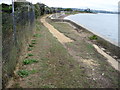
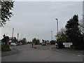
Photos of PO3 5PW


Area Information
Living in PO3 5PW offers a specific residential experience defined by a tight-knit cluster of homes. This postcode area forms part of the wider PO3 sector in southern England, serving a distinct population of 1,657 residents. The scale is intimate, yet the location provides straightforward access to the infrastructure required for modern living. You will find yourself in a setting where daily needs are met by nearby services rather than distant main towns. The environment is entirely suited to established households, reflecting a community that has grown organically around practical considerations. Residents here enjoy a clear understanding of their surroundings without the noise or complexity of a larger metropolitan centre. The area functions as a quiet residential base, removed from immediate industrial zones while remaining connected to Portsmouth's broader network. Daily life revolves around reliable access to transport links and essential amenities located just metres away. This makes PO3 5PW an attractive option for buyers seeking stability and familiarity. You do not need to commute to distant shopping districts, as your immediate neighbourhood supports independent living. The character is substantive, focusing on actual utility rather than flashy commercial development.
- Area Type
- Postcode
- Area Size
- Not available
- Population
- 1657
- Population Density
- 1837 people/km²
The property market in PO3 5PW is characterised by a near-total dominance of owner-occupation. With 82% of residents owning their homes, the area stands in stark contrast to the high-rental markets found in cities across the UK. The accommodation type is strictly houses, meaning every listed property in this postcode cluster is a detached, semi-detached, or terraced house rather than a flat or apartment. This singular focus on households alters the buyer's perspective significantly. You will not find purpose-built rental blocks here; the stock consists of traditional family dwellings. This market structure implies that demand is driven by local buyers seeking to settle down rather than investors hunting for yield. The value proposition lies in the security of tenure and the absence of landlord turnover. As a small residential cluster, the number of available properties may be limited at any given time, potentially driving competition among the few interested parties. Prospective buyers should act quickly if they spot a listing, as the 82% ownership rate suggests low churn. The housing stock is built for families, offering space that is increasingly rare in new build developments. If you value a private garden, a driveway, or a sense of community derived from other homeowners, PO3 5PW delivers this without compromise. The market here is defined by asset ownership, not by temporary leases.
House Prices in PO3 5PW
No properties found in this postcode.
Energy Efficiency in PO3 5PW
Residents of PO3 5PW enjoy a lifestyle defined by immediate access to major retail anchors and transport hubs. You can walk to Morisons Anchorage, M&S Ocean, and Lidl Ocean, which serves as the primary retail corridor for the postcode. These specific outlets provide everything from groceries to clothing without needing to travel to larger town centres. For shoppers seeking value, the presence of these three distinct retailers means you can compare prices and stock immediately from your doorstep. This concentration of stores benefits families saving on weekly bills, as the trip to the shops becomes a quick errand rather than a full-day commitment. Transport options are extensive and diverse, offering flexibility for those without cars. Five rail stations are within practical reach, including Hilsea, Cosham, and Fratton Railway Stations, giving you multiple choices for commuting to Portsmouth or Southampton. Similarly, five ferry landing points serve the area, notably Eastney, the International Cruise & Ferry Terminal, and Hayling Island. These connections open up a wider world, allowing residents to holiday in the New Forest or visit ports of call with ease. The lifestyle in PO3 5PW balances the calm of residential living with the convenience of major commercial networks. You get the security of a quiet home while retaining the option to engage with the wider city. Daily life is efficient, supported by a network of amenities that are just a short journey away by foot or train.
Amenities
Schools
Families living in PO3 5PW benefit from close proximity to Admirals Lord Nelson School. This institution operates with a dual identity, functioning as both a primary school and an academy. The academy status ensures it follows national educational standards while maintaining local ties. Crucially, the school holds a 'Good' Ofsted rating, which provides tangible assurance of quality education for children residing in the area. This is the only educational facility listed for this specific postcode, meaning residents look towards this single establishment for their children's academic needs within the immediate vicinity. While data does not list a separate secondary school, the presence of Admirals Lord Nelson School suggests a reliable educational foundation for young families. The 'Good' rating indicates that the school meets rigorous government standards, ensuring that learning environments are safe and effective. For parents moving into PO3 5PW, proximity to this rated institution reduces daily travel time and fosters community involvement in school activities. The blend of primary and academy functions offers a continuum of care, though prospective parents should verify the transition to secondary stage if their children age out of the primary section. Nearby amenities support the school community, with parents likely walking their children to gates before heading to local shops. This educational focus makes PO3 5PW a logical choice for housing near successful state-funded learning environments.
| Rank | School | Type | Entry gender | Ages |
|---|
Explore more schools in this area
Go to Schools tabDemographics
The community within PO3 5PW displays a clear profile of established homeowners. Eighty-two percent of residents own their homes, indicating a deeply rooted population stable over time. The most common age group is adults between 30 and 64 years, meaning the area is populated by individuals likely to have children or young adults. The median age sits at 47, further confirming that families and older households dominate the social fabric. Accommodation types are exclusively houses, with no flats recorded in this specific cluster. This structural consistency means you will not encounter high-density living blocks or mixed-use developments on your street. Ethnically, the area is predominantly White, reflecting a homogenous community structure typical of many established English suburbs. Data does not provide specific figures for minority groups, but the overwhelming majority clarifies the cultural context. There is no indication of transient populations or large rental towers, which contrasts sharply with London or Leeds. Because 82% of households own their property, the local economy is heavily influenced by long-term investment rather than short-term letting. This demographic stability suggests a calm environment where neighbours know each other and local governance addresses the concerns of a settled citizenry. When you consider homes in PO3 5PW, you are stepping into a space defined by permanence and traditional family values.
Household Size
Accommodation Type
Tenure
Ethnic Group
Religion
Household Composition
Age
Household Deprivation
NS-SEC
Explore more demographic insights in this area
Go to Demographics tabPlanning
Planning Constraints
- Flood RiskPremium
- Ramsar Wetland SitesPremium
- Area of Outstanding Natural BeautyPremium
- Protected Nature ReservePremium
- Protected WoodlandPremium