Area Overview for PO3 5LD
Photos of PO3 5LD
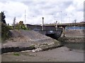
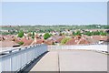
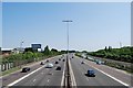
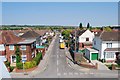
100 photos from this area
Area Information
Key information about the PO3 5LD including its size, population, and administrative classification.
- Area Type
- Postcode
- Area Size
- 3.6 hectares
- Population
- 1777
- Population Density
- 3176 people/km²
House Prices in PO3 5LD
28
Properties
£226,331
Average Sold Price
£120,500
Lowest Price
£485,000
Highest Price
Showing 28 properties
| Address | Type | Beds | Baths | Last Sale Price | Last Sale Date | |
|---|---|---|---|---|---|---|
| 27 Peronne Road, Portsmouth, PO3 5LD | Semi-detached | 3 | 1 | £360,000 | May 2024 | |
| 25 Peronne Road, Portsmouth, PO3 5LD | Semi-detached | 3 | 1 | £315,000 | Mar 2024 | |
| 19 Peronne Road, Portsmouth, PO3 5LD | Detached | 3 | 1 | £485,000 | Jun 2023 | |
| 23 Peronne Road, Portsmouth, PO3 5LD | Semi-detached | 3 | 1 | £360,000 | Mar 2023 | |
| 39 Peronne Road, Portsmouth, PO3 5LD | house | - | - | £240,000 | Mar 2022 | |
| 43 Peronne Road, Portsmouth, PO3 5LD | house | - | - | £227,500 | Jan 2022 | |
| 33 Peronne Road, Portsmouth, PO3 5LD | Terraced | 2 | 1 | £250,000 | Jul 2020 | |
| 45 Peronne Road, Portsmouth, PO3 5LD | Terraced | 2 | 1 | £225,000 | Dec 2018 | |
| 21 Peronne Road, Portsmouth, PO3 5LD | house | 2 | 1 | £253,000 | Jun 2015 | |
| 30 Peronne Road, Portsmouth, PO3 5LD | house | - | - | £168,250 | Feb 2013 |
Page 1 of 3
Energy Efficiency in PO3 5LD
Amenities
Schools
| Rank | School | Type | Entry gender | Ages |
|---|
Explore more schools in this area
Go to Schools tabDemographics
Household Size
Family (3-5 people)
most common
Accommodation Type
Flats
most common
Tenure
62
majority
Ethnic Group
White
most common
Religion
N/A
most common
Household Composition
N/A
most common
Age
47
median
Adults (30-64 years)
most common
Household Deprivation
N/A
with no deprivation
NS-SEC
34
in Lower managerial occupations
Explore more demographic insights in this area
Go to Demographics tabPlanning
Planning Constraints
- Flood RiskPremium
- Ramsar Wetland SitesPremium
- Area of Outstanding Natural BeautyPremium
- Protected Nature ReservePremium
- Protected WoodlandPremium