Area Overview for PO3 5DP
Photos of PO3 5DP
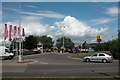
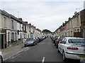
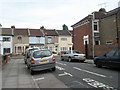
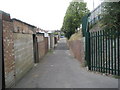
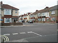
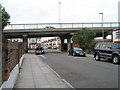
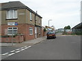
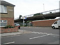
100 photos from this area
Area Information
Key information about the PO3 5DP including its size, population, and administrative classification.
- Area Type
- Postcode
- Area Size
- 6911 m²
- Population
- 1657
- Population Density
- 1837 people/km²
House Prices in PO3 5DP
18
Properties
£166,672
Average Sold Price
£51,500
Lowest Price
£372,000
Highest Price
Showing 18 properties
| Address | Type | Beds | Baths | Last Sale Price | Last Sale Date | |
|---|---|---|---|---|---|---|
| 33 Burrfields Road, Portsmouth, PO3 5DP | house | 4 | - | £372,000 | Feb 2023 | |
| 13 Burrfields Road, Portsmouth, PO3 5DP | house | - | - | £232,000 | Jul 2021 | |
| 17 Burrfields Road, Portsmouth, PO3 5DP | house | - | - | £275,000 | Jul 2018 | |
| 9 Burrfields Road, Portsmouth, PO3 5DP | Terraced | 3 | 1 | £230,000 | May 2018 | |
| 21 Burrfields Road, Portsmouth, PO3 5DP | Terraced | 3 | 1 | £202,000 | Dec 2015 | |
| 5 Burrfields Road, Portsmouth, PO3 5DP | Terraced | - | - | £112,000 | Sep 2007 | |
| 1 Burrfields Road, Portsmouth, PO3 5DP | Terraced | - | - | £180,000 | Oct 2006 | |
| 3 Burrfields Road, Portsmouth, PO3 5DP | house | - | - | £165,000 | May 2006 | |
| 15 Burrfields Road, Portsmouth, PO3 5DP | Terraced | - | - | £145,000 | Mar 2006 | |
| 7 Burrfields Road, Portsmouth, PO3 5DP | Terraced | - | - | £69,995 | Jul 1998 |
Page 1 of 2
Energy Efficiency in PO3 5DP
Amenities
Schools
| Rank | School | Type | Entry gender | Ages |
|---|
Explore more schools in this area
Go to Schools tabDemographics
Household Size
Family (3-5 people)
most common
Accommodation Type
Houses
most common
Tenure
82
majority
Ethnic Group
White
most common
Religion
N/A
most common
Household Composition
N/A
most common
Age
47
median
Adults (30-64 years)
most common
Household Deprivation
N/A
with no deprivation
NS-SEC
28
in Lower managerial occupations
Explore more demographic insights in this area
Go to Demographics tabPlanning
Planning Constraints
- Flood RiskPremium
- Ramsar Wetland SitesPremium
- Area of Outstanding Natural BeautyPremium
- Protected Nature ReservePremium
- Protected WoodlandPremium