Area Overview for PO22 9ED
Photos of PO22 9ED
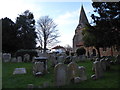
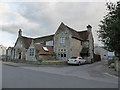
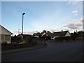
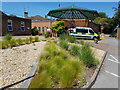
67 photos from this area
Area Information
Key information about the PO22 9ED including its size, population, and administrative classification.
- Area Type
- Postcode
- Area Size
- 2.3 hectares
- Population
- 1390
- Population Density
- 5338 people/km²
House Prices in PO22 9ED
29
Properties
£232,831
Average Sold Price
£140,000
Lowest Price
£358,000
Highest Price
Showing 29 properties
| Address | Type | Beds | Baths | Last Sale Price | Last Sale Date | |
|---|---|---|---|---|---|---|
| 95B Hazel Road, Bersted, PO22 9ED | Flat | - | - | £153,500 | Feb 2025 | |
| 61 Hazel Road, Bersted, PO22 9ED | Bungalow | 2 | - | £277,000 | Nov 2024 | |
| 65 Hazel Road, Bersted, PO22 9ED | Semi-detached | 2 | 1 | £275,000 | Oct 2024 | |
| 59 Hazel Road, Bersted, PO22 9ED | Semi-detached | 2 | 1 | £340,000 | Nov 2022 | |
| 49 Hazel Road, Bersted, PO22 9ED | Bungalow | 2 | - | £310,000 | Sep 2022 | |
| 47 Hazel Road, Bersted, PO22 9ED | Bungalow | - | - | £358,000 | Oct 2021 | |
| 53 Hazel Road, Bersted, PO22 9ED | Bungalow | - | - | £260,000 | Apr 2021 | |
| 51 Hazel Road, Bersted, PO22 9ED | Bungalow | - | - | £240,000 | Feb 2021 | |
| 55 Hazel Road, Bersted, PO22 9ED | Bungalow | 2 | 1 | £284,000 | Feb 2020 | |
| 69 Hazel Road, Bersted, PO22 9ED | Bungalow | 3 | 1 | £228,500 | Sep 2019 |
Page 1 of 3
Energy Efficiency in PO22 9ED
Amenities
Schools
| Rank | School | Type | Entry gender | Ages |
|---|
Explore more schools in this area
Go to Schools tabDemographics
Household Size
Two person
most common
Accommodation Type
Houses
most common
Tenure
81
majority
Ethnic Group
White
most common
Religion
N/A
most common
Household Composition
N/A
most common
Age
47
median
Adults (30-64 years)
most common
Household Deprivation
N/A
with no deprivation
NS-SEC
23
in Lower managerial occupations
Explore more demographic insights in this area
Go to Demographics tabPlanning
Planning Constraints
- Flood RiskPremium
- Ramsar Wetland SitesPremium
- Area of Outstanding Natural BeautyPremium
- Protected Nature ReservePremium
- Protected WoodlandPremium