Area Overview for PO22 7DX
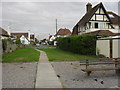
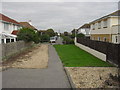
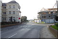
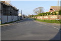
Photos of PO22 7DX


Area Information
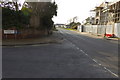
The postcode PO22 7DX represents a compact residential cluster with a defined footprint of 888 square metres. This specific area forms part of the broader PO22 district in England, serving a population of 1,575 people. Living in PO22 7DX means inhabiting a densely populated pocket where residents benefit from a tight-knit, large-scale community structure despite the small physical area. The location functions as a concentrated neighbourhood typical of the Greater London area, though its specific geographic classification remains tied to this precise postcode. Prospective buyers should recognise that this postcode covers a limited space, which often implies a shared environment where proximity between households is significant. The area's identity is rooted in this specific population density and clustering pattern. Residents of PO22 7DX share immediate proximity with neighbours, creating a distinct sense of locality within the wider PO22 region. The area serves as a defined micro-community where daily life revolves around close quarters. Anyone considering homes in PO22 7DX must account for the small spatial scale that defines this residential zone.
- Area Type
- Postcode
- Area Size
- 888 m²
- Population
- 1575
- Population Density
- 2881 people/km²
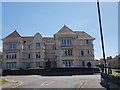
Homes in PO22 7DX exist within a market defined by a high rate of owner-occupation. The data reveals that 71% of households own their property, which paints a clear picture of this as an owner-occupied area rather than a rental hub. This high percentage translates into a stable housing stock where owners have a vested interest in maintaining their residences. The predominant accommodation type consists of houses, making this postcode attractive to buyers seeking standalone properties rather than shared flats. Prospective purchasers should note that selling or renting a home here will involve engaging with a community where most neighbours hold similar tenure. The fact that the area is primarily one of houses suggests a layout conducive to gardens or private outdoor space, though the small total area of 888 square metres implies these plots may be compact. The dominance of house ownership often signals lower volatility compared to mixed-use rental zones. Buyers seeking a traditional footprint will find PO22 7DX aligned with their requirements. The local market reflects a preference for permanence and private ownership among its neighbours. This structure supports capital retention and community investment over speculative trading cycles.
House Prices in PO22 7DX
Showing 3 properties
| Address | Type | Beds | Baths | Last Sale Price | Last Sale Date | |
|---|---|---|---|---|---|---|
| 3, Turret House Mews, Limmer Lane, Felpham, PO22 7DX | house | - | - | - | - | |
| 2, Turret House Mews, Limmer Lane, Felpham, PO22 7DX | house | - | - | - | - | |
| 1, Turret House Mews, Limmer Lane, Felpham, PO22 7DX | house | - | - | - | - |
Energy Efficiency in PO22 7DX
Residents of PO22 7DX enjoy practical access to major retail and transport hubs within reasonable travelling distance. The nearest retail options include Tesco Bognor, Sainsburys Bognor, and M&S Bognor, providing comprehensive shopping needs from groceries to clothing. These supermarkets are located close enough to ensure regular shopping trips remain efficient. Transport links are equally robust, with five railway stations identified nearby that facilitate regional travel. Bognor Regis Railway Station, Barnham Railway Station, and Ford Railway Station offer frequent connections for commuters. Living in PO22 7DX means having access to multiple transport corridors without needing a car for every journey. These stations serve the wider PO22 network, connecting residents to Brighton, London, and surrounding boroughs. The presence of five distinct rail options suggests flexibility in choosing departure times and routes. Daily life involves easy access to essentials via Tesco and Sainsburys, while leisure trips utilise the rail network. The area balances local convenience with broader regional connectivity effectively. Shopkeepers at Bognor and commuters to London form the functional rhythm of this neighbourhood.
Amenities
Schools
| Rank | School | Type | Entry gender | Ages |
|---|
Explore more schools in this area
Go to Schools tabDemographics
The community profile within PO22 7DX reflects a mature demographic with a median age of 47 years. The most common age range comprises adults between 30 and 64 years, indicating a stability often found in established neighbourhoods. Housing data reveals that 71% of residents are homeowners, suggesting a settled population with strong ties to the locality. Accommodation in PO22 7DX consists primarily of houses, distinguishing it from areas dominated by flats or maisonettes. The demographic make-up is predominantly White, aligning with the broader profiles of the HO household type found in similar districts. This age distribution and ownership rate point toward an area mastered by families and long-term residents rather than transient renters. With over two-thirds of households owning their property, the social fabric likely relies on stability. The concentration of older adults suggests a community accustomed to specific amenities and transport needs. Statistics on deprivation are not available for this specific postcode, though the high ownership rate often correlates with economic stability. The absence of young residents under 30 may influence local school demand and business offerings. Understanding that the typical resident is a middle-aged homeowner helps frame expectations for the character of PO22 7DX.
Household Size
Accommodation Type
Tenure
Ethnic Group
Religion
Household Composition
Age
Household Deprivation
NS-SEC
Explore more demographic insights in this area
Go to Demographics tabPlanning
Planning Constraints
- Flood RiskPremium
- Ramsar Wetland SitesPremium
- Area of Outstanding Natural BeautyPremium
- Protected Nature ReservePremium
- Protected WoodlandPremium