Area Overview for PO22 6NJ
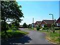
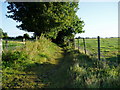
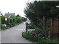
Photos of PO22 6NJ


Area Information
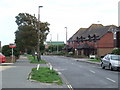
PO22 6NJ is a compact residential cluster covering just 2.8 hectares. This small footprint supports a population of 1,515 people, creating a tight-knit environment where neighbours are often known. The area functions as a distinct postcode zone within the broader Bognor Regis region, offering a blend of quiet suburban living and convenient access to local services. Historically, this location has shifted towards an older demographic, which influences the character of the community and the style of properties available. The density reaches 1,186 people per square kilometre, indicating a moderately populated street layout rather than sprawling development. Life here revolves around the immediate surroundings, with daily routines shaped by proximity to nearby towns like Bognor Regis and Barnham. You will find that the area serves as a settled home for many families and individuals who prioritise a manageable pace over urban excitement. The postcode addresses a specific group of homes, meaning any inquiry about your potential move must consider the immediate cluster of residences within this defined boundary. This area does not offer extensive green belts or urban centres within its own limits, relying instead on the wider town infrastructure for major activities.
- Area Type
- Postcode
- Area Size
- 2.8 hectares
- Population
- 1515
- Population Density
- 1186 people/km²
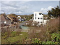
The property market in PO22 6NJ is defined by a predominantly owner-occupied housing stock. With 87% of residents owning their homes, you are entering an area where the majority of houses have been in the same family for years. The accommodation type is exclusively houses, meaning there are no flats or purpose-built rental blocks within this specific postcode cluster. This high ownership percentage indicates that new construction is less likely than second-hand sales or renovations of existing properties. Buyers looking to live in PO22 6NJ will find a market characterised by continuity and established structures. The density of 1,186 people per square kilometre across only 2.8 hectares suggests a collection of standard residential terraces or detached cottages rather than a mix of modern developments. Because the population is mostly elderly and home ownership is so prevalent, the inventory will skew towards properties suitable for older adults or families with space to retire. Expect prices to reflect this stability, though specific current valuation figures for individual listings are not part of this area profile. The lack of rental apartments means that investment in buy-to-let is less relevant here than in mixed-use districts. When purchasing, you are acquiring a stake in a longstanding community structure where the housing type remains consistent.
House Prices in PO22 6NJ
Showing 7 properties
| Address | Type | Beds | Baths | Last Sale Price | Last Sale Date | |
|---|---|---|---|---|---|---|
| Ancton Barn, Ancton Lane, Middleton On Sea, PO22 6NJ | Semi-detached | 3 | 2 | £635,000 | Jul 2020 | |
| Ancton Manor, Ancton Lane, Middleton On Sea, PO22 6NJ | Detached | 6 | - | £942,500 | Mar 2016 | |
| Ramalla House, Ancton Lane, Middleton On Sea, PO22 6NJ | Detached | 4 | 2 | £439,950 | Dec 2014 | |
| Cottage Farm, Ancton Lane, Middleton On Sea, PO22 6NJ | Detached | 4 | 3 | £340,000 | Jun 2012 | |
| Y Not, Ancton Lane, Middleton On Sea, PO22 6NJ | Semi-detached | - | - | £240,000 | Dec 2004 | |
| If Not, Ancton Lane, Middleton On Sea, PO22 6NJ | Semi-detached | 4 | - | - | - | |
| Elms Farm, Ancton Lane, Middleton On Sea, PO22 6NJ | Detached | - | - | - | - |
Energy Efficiency in PO22 6NJ
Daily life in PO22 6NJ relies on a curated selection of amenities within walking or short driving distance. You have access to five retail outlets including Tesco Bognor, The Southern Co-operative Co, and Sainsburys Bognor. These stores form the core of your grocery and daily shopping requirements, eliminating the need for long travel for basic supplies. For rail travel, five local stations provide a network for journeys across the South coast. Key stops include Ford Railway Station, Barnham Railway Station, and Bognor Regis Railway Station. These points of transport allow you to access broader job markets or leisure centres in larger towns. While the 2.8-hectare boundary does not contain its own parks or large shopping malls, the proximity to Bognor Regis ensures significant leisure facilities are just outside the immediate cluster. The area is walkable in terms of essentials, with residential roads leading directly to the named supermarkets. You will find that your lifestyle is supported by these five retail hubs rather than by large outdoor commercial zones. Dining options and larger entertainment venues depend on the nearby towns, making the local streets primarily good for errands and quick community stops. This layout suits residents who prefer convenience centres over sprawling entertainment districts.
Amenities
Schools
| Rank | School | Type | Entry gender | Ages |
|---|
Explore more schools in this area
Go to Schools tabDemographics
The community profile in PO22 6NJ reflects a settled, mature population. The median age stands at 47 years, significantly higher than the national average for many parts of the UK. Most residents fall into the elderly category, with 65 years or older being the most common age range. This demographic shift suggests a neighbourhood where long-term residents dominate the social fabric. Home ownership is exceptionally high, with 87% of households owning their property outright or with a mortgage. Only a small minority rents, which typically stabilises the community and reduces turnover. The accommodation stock consists almost entirely of houses, rather than the flats more common in urban regeneration zones. Ethnic diversity is concentrated, with the White group forming the predominant demographic. These figures paint a picture of a traditional, established residential area where the average resident likely values stability and tenure. You are looking at a built environment catered towards a demographic that has already established deep roots. This stability often translates to quieter streets and neighbourly engagement, though it may limit diversity in terms of age and background. The high ownership rate also means that leasehold complications or rental disputes are rare concerns for those browsing homes in this postcode.
Household Size
Accommodation Type
Tenure
Ethnic Group
Religion
Household Composition
Age
Household Deprivation
NS-SEC
Explore more demographic insights in this area
Go to Demographics tabPlanning
Planning Constraints
- Flood RiskPremium
- Ramsar Wetland SitesPremium
- Area of Outstanding Natural BeautyPremium
- Protected Nature ReservePremium
- Protected WoodlandPremium