Area Overview for PO22 6LS
Photos of PO22 6LS
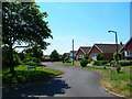


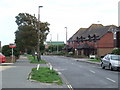
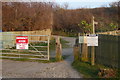


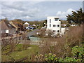
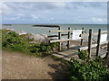
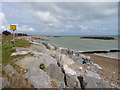

34 photos from this area
Area Information
Key information about the PO22 6LS including its size, population, and administrative classification.
- Area Type
- Postcode
- Area Size
- 4.3 hectares
- Population
- 1515
- Population Density
- 1186 people/km²
House Prices in PO22 6LS
30
Properties
£289,278
Average Sold Price
£116,500
Lowest Price
£467,000
Highest Price
Showing 30 properties
| Address | Type | Beds | Baths | Last Sale Price | Last Sale Date | |
|---|---|---|---|---|---|---|
| 22 Sunnymead Close, Middleton On Sea, PO22 6LS | Detached | 3 | 2 | £460,000 | Nov 2025 | |
| 5 Sunnymead Close, Middleton On Sea, PO22 6LS | Bungalow | 3 | 2 | £343,000 | Aug 2024 | |
| 12 Sunnymead Close, Middleton On Sea, PO22 6LS | Bungalow | 3 | - | £240,000 | May 2023 | |
| 28 Sunnymead Close, Middleton On Sea, PO22 6LS | Bungalow | 3 | 2 | £467,000 | Sep 2022 | |
| 9 Sunnymead Close, Middleton On Sea, PO22 6LS | Bungalow | - | - | £375,000 | Dec 2021 | |
| Bongate House, 23 Sunnymead Close, Middleton On Sea, PO22 6LS | house | - | - | £375,000 | Jul 2021 | |
| 18 Sunnymead Close, Middleton On Sea, PO22 6LS | Bungalow | - | - | £330,000 | Dec 2020 | |
| 20 Sunnymead Close, Middleton On Sea, PO22 6LS | Detached | - | - | £360,000 | Nov 2020 | |
| 32 Sunnymead Close, Middleton On Sea, PO22 6LS | Bungalow | 3 | 1 | £340,000 | Oct 2019 | |
| 16 Sunnymead Close, Middleton On Sea, PO22 6LS | Bungalow | 2 | - | £399,950 | Nov 2018 |
Page 1 of 3
Energy Efficiency in PO22 6LS
Amenities
Schools
| Rank | School | Type | Entry gender | Ages |
|---|
Explore more schools in this area
Go to Schools tabDemographics
Household Size
Two person
most common
Accommodation Type
Houses
most common
Tenure
87
majority
Ethnic Group
White
most common
Religion
N/A
most common
Household Composition
N/A
most common
Age
47
median
Elderly (65+ years)
most common
Household Deprivation
N/A
with no deprivation
NS-SEC
34
in Lower managerial occupations
Explore more demographic insights in this area
Go to Demographics tabPlanning
Planning Constraints
- Flood RiskPremium
- Ramsar Wetland SitesPremium
- Area of Outstanding Natural BeautyPremium
- Protected Nature ReservePremium
- Protected WoodlandPremium