Area Overview for PO22 0FD
Photos of PO22 0FD
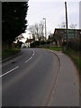
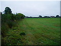
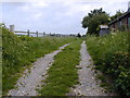
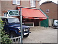
35 photos from this area
Area Information
Key information about the PO22 0FD including its size, population, and administrative classification.
- Area Type
- Postcode
- Area Size
- 2.7 hectares
- Population
- 2478
- Population Density
- 473 people/km²
House Prices in PO22 0FD
37
Properties
£457,799
Average Sold Price
£255,048
Lowest Price
£528,956
Highest Price
Showing 37 properties
| Address | Type | Beds | Baths | Last Sale Price | Last Sale Date | |
|---|---|---|---|---|---|---|
| 38 Lapwing Grove, Barnham, PO22 0FD | Detached | 3 | 3 | £492,500 | Mar 2025 | |
| 33 Lapwing Grove, Barnham, PO22 0FD | Detached | 3 | 3 | £525,000 | Oct 2023 | |
| 1 Lapwing Grove, Barnham, PO22 0FD | house | - | - | £470,000 | Jan 2020 | |
| 35 Lapwing Grove, Barnham, PO22 0FD | house | - | - | £429,950 | Mar 2019 | |
| 34 Lapwing Grove, Barnham, PO22 0FD | house | - | - | £444,950 | Dec 2018 | |
| 27 Lapwing Grove, Barnham, PO22 0FD | house | - | - | £255,048 | Sep 2018 | |
| 37 Lapwing Grove, Barnham, PO22 0FD | house | - | - | £515,989 | Jun 2018 | |
| 2 Lapwing Grove, Barnham, PO22 0FD | house | - | - | £528,956 | May 2018 | |
| 31 Lapwing Grove, Barnham, PO22 0FD | Detached | 2 | 1 | - | - | |
| 14 Lapwing Grove, Barnham, PO22 0FD | Detached | 3 | - | - | - |
Page 1 of 4
Energy Efficiency in PO22 0FD
Amenities
Schools
| Rank | School | Type | Entry gender | Ages |
|---|
Explore more schools in this area
Go to Schools tabDemographics
Household Size
Two person
most common
Accommodation Type
Houses
most common
Tenure
84
majority
Ethnic Group
White
most common
Religion
N/A
most common
Household Composition
N/A
most common
Age
47
median
Adults (30-64 years)
most common
Household Deprivation
N/A
with no deprivation
NS-SEC
40
in Lower managerial occupations
Explore more demographic insights in this area
Go to Demographics tabPlanning
Planning Constraints
- Flood RiskPremium
- Ramsar Wetland SitesPremium
- Area of Outstanding Natural BeautyPremium
- Protected Nature ReservePremium
- Protected WoodlandPremium